
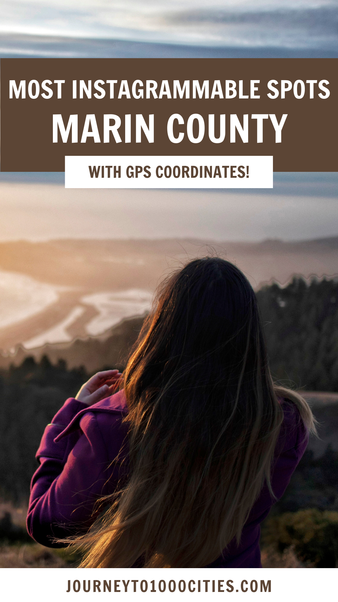
Most Instagrammable Spots in Marin County, SF Bay Area

It took me two decades of living in the Bay Area to discover just how beautiful and accessible Marin County is.
This list only covers the Marin County. For more of my favorite Instagrammable spots in the Bay Area, check out my other posts on San Francisco and the South Bay.
Here are the Most Instagrammable Spots in Marin County, SF Bay Area
I’ve also created a map with EXACTLY where to I took these photographs at the end. These pins come directly from the GPS marker on my photos.

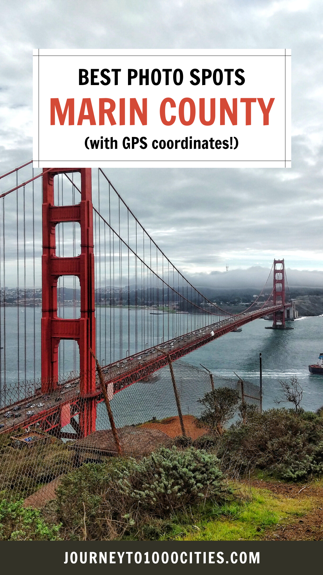
Battery Spencer
I’ve taken pictures of the Golden Gate Bridge from dozens of viewpoints from three counties, but Battery Spencer is probably my favorite spot. You can’t beat this view.
Map Coordinates: 37°49'40.4"N 122°28'54.8"W
Admission: Free
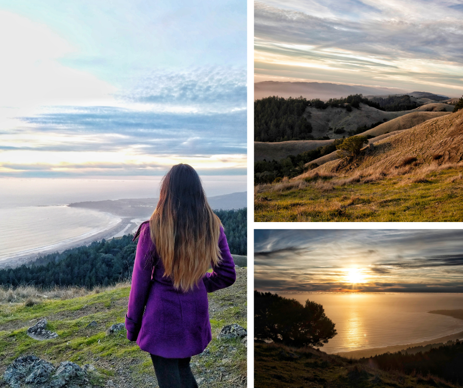
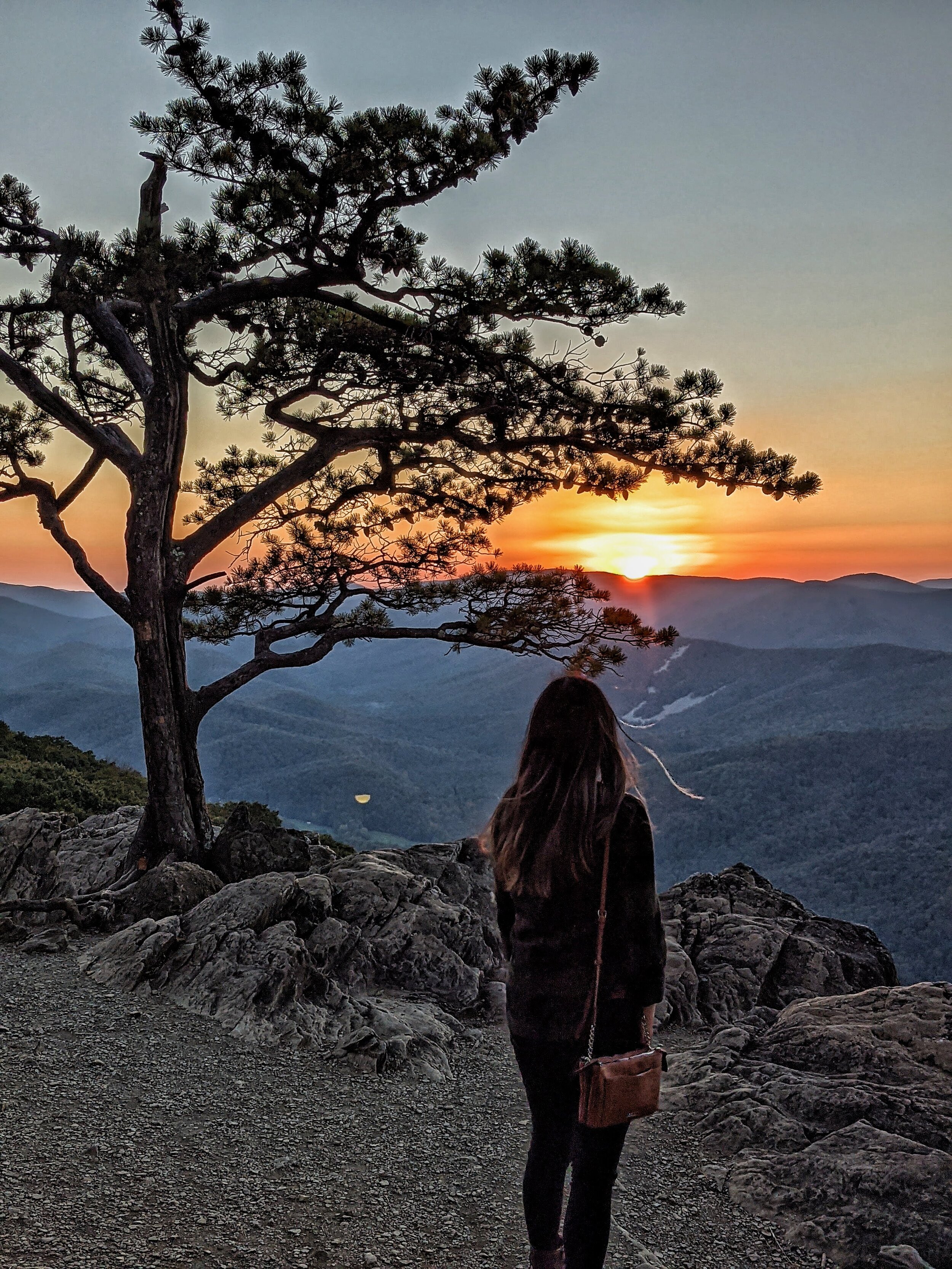
Mount Tamalpais
Mount Tamalpais is huge and offers some of the best views in the Bay whether you’re driving or hiking. If you come on a day Karl (the Fog) makes a visit, you will feel like you’re standing above the clouds here! Mt. Tam’s East Peak is well known offering an incredible vista of the Bay, but I personally enjoy the rolling hills and this view of Stinson Beach more.
Map Coordinates: 37°54'38.1"N 122°37'30.1"W
Admission: $8

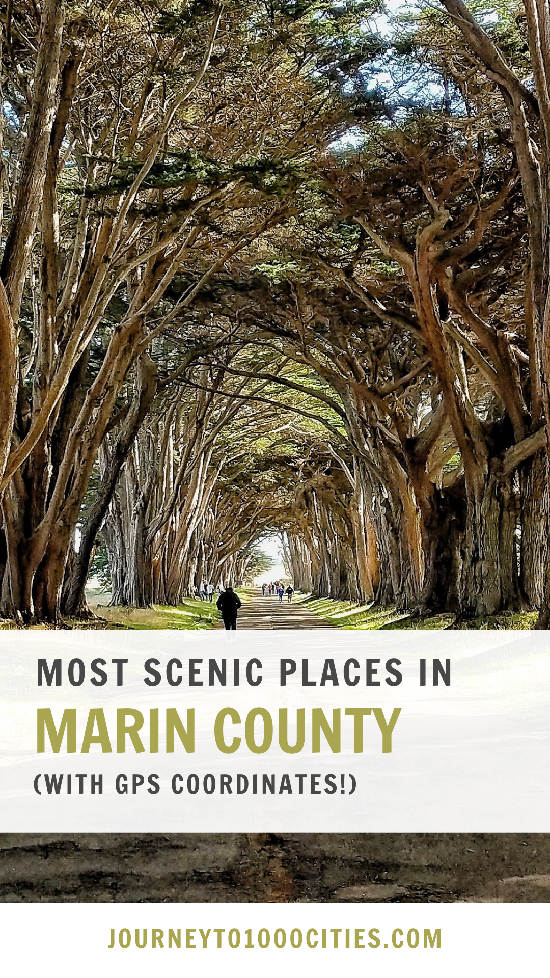
Cypress tree tunnel
This is one of the most surreal places in the Bay Area. I’ve always thought that one would have to fly 12 hours somewhere to see tree tunnels, but there’s one right in Marin County! If you come during sunset when the light peeks through the trees just right, it will make for a stunning photo.
Map Coordinates: 38°05'35.3"N 122°56'41.5"W
Admission: Free

Point Reyes Shipwreck
I think the Point Reyes Shipwreck is one of the most small but stunning gems I’ve found in the North Bay. This boat is pretty small, and its location is pretty random. It doesn’t have a significant historical story, but it is a great subject for a gorgeous photo.
Address: 12783 Sir Francis Drake Blvd, Inverness, CA 94937
Admission: Free

Waldo Point Harbor (Sausalito House Boats)
You don’t have to go to Venice to see floating homes! Actually, not even Venice has houseboats like this. The Waldo Point Harbor offers more than 200 houseboats, each uniquely designed and makes for fun photography. I thought these houses were so creative!
Address: 1 Gate 5 Rd C, Sausalito, CA 94965
Admission: Free
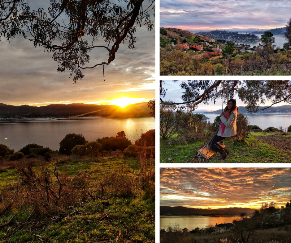
Hippie Tree
Came for the swing. Stayed for the gorgeous view of the SF skyline and sunset. I had no idea Tiburon sunsets were this beautiful.
Map Coordinates: 37°53'28.4"N 122°28'24.6"W
Admission: Free

Shoreline Park
Stunning views of the Golden Gare Bridge and sunset. It also connects to downtown Tiburon, which is a really cute place to visit!
Address: 311 Paradise Dr, Tiburon, CA 94920
Admission: Free

Muir Woods
A walk through Muir Woods is a walk through paradise. The gorgeous tall red wood trees here and abundance of moss on everything make for beautiful photography.
(Think Korok Forest, but IRL.)
Map Coordinates: 37°55'55.0"N 122°38'08.3"W
Admission: $15
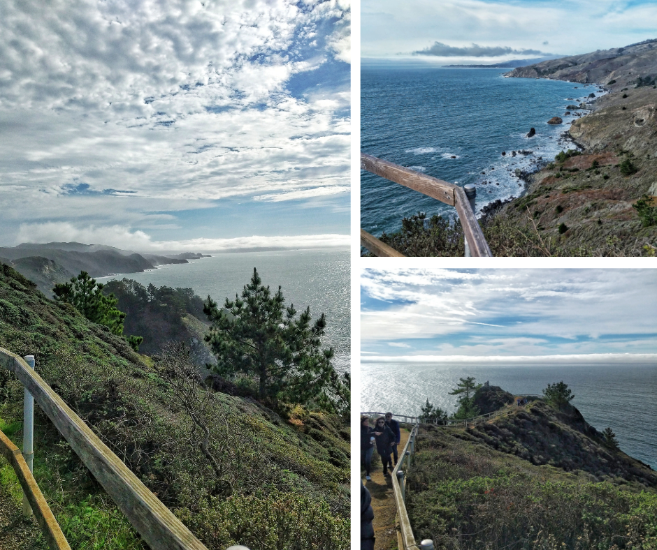
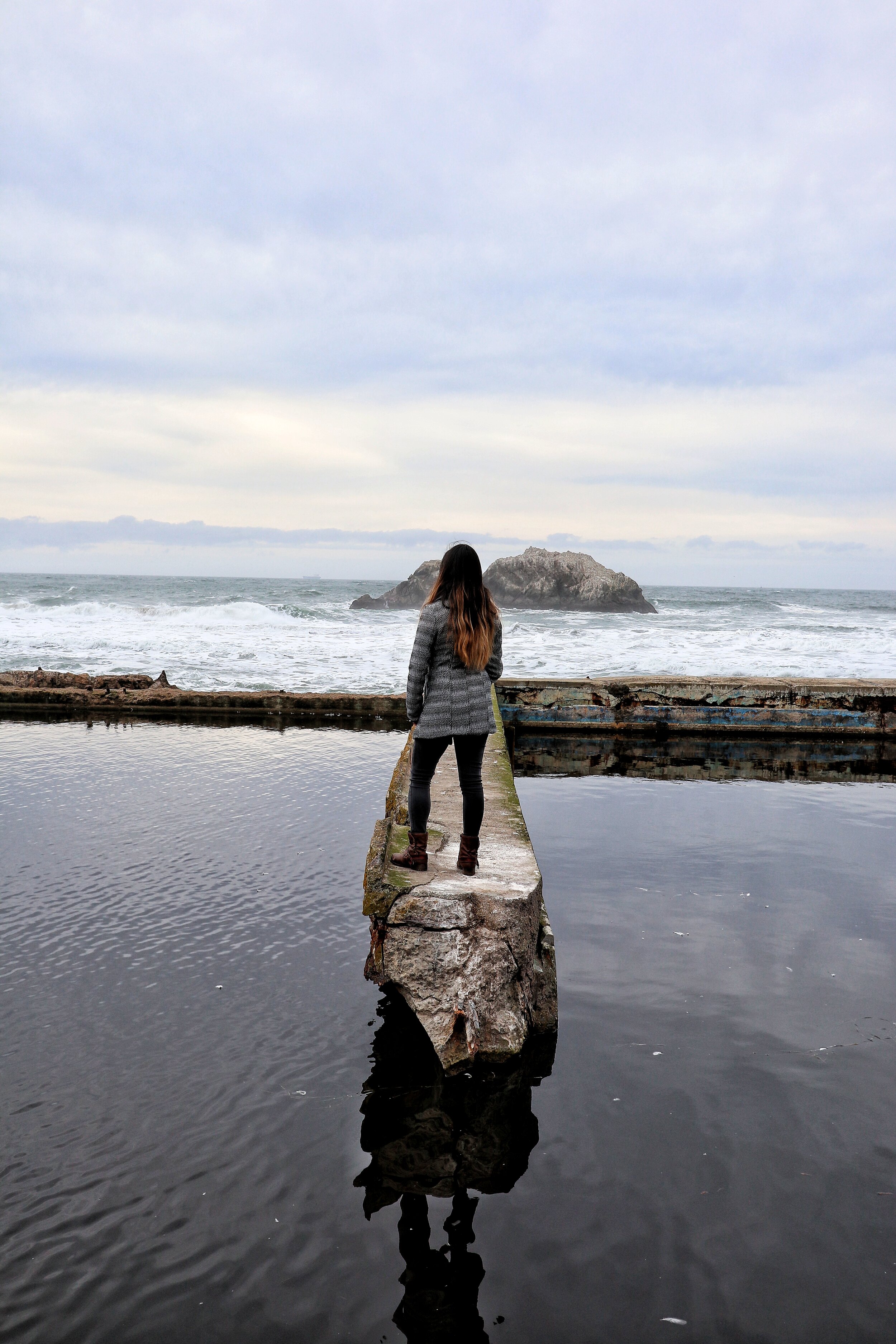
Muir Beach Overlook
The Muir Beach Overlook offers stunning views of the ocean. I couldn’t capture the iconic photo that many people have of this staircase and overlook because there were too many people, the view of the ocean itself is still more than worth a visit.
Address: Muir Beach Overlook, Muir Beach, CA 94965
Admission: Free

Hawk Hill
One of the best places to photograph the Golden Gate Bridge in its entirety. I can only imagine how stunning this view with be when Karl (the Fog) is visiting.
Map Coordinates: 37°49'41.7"N 122°29'51.7"W
Admission: Free
Map of the Most Instagrammable Places in Marin County, San Francisco Bay Area
Here’s a map of exactly where you can get the best Instagram photos in Marin County for your next trip. In order to use it, just open it on your phone and these pins should show up when you get to the island.
My most instagrammable maps include photos and a description at each pin so you know what you’re heading to.
You can also save and customize my maps for your own trip planning! Just click on the ‘view larger’ rectangle on the right hand corner -> copy map, and now you have a copy that you can customize to your interests during your visit!
Pin it for Later!


Hi there! I'm Tari, and I’m embarking on a journey to 1000 cities. I’ll learn a lot about food, culture, photography, and customs along the way, so sharing my learnings and travel tips here!
This is the only travel blog that will offer fully customized and downloadable maps for your photo needs down to the GPS marker.
Follow me on IG: @Journeyto1000Cities