The Most Beautiful Photo Spots in Japan (With Maps!)
Japan has a way of surprising you. One day you're in the neon glow of Tokyo, the next you're standing in front of a thousand-year-old temple wrapped in morning mist. It's a country of contrasts—ancient traditions alongside cutting-edge modernity, peaceful bamboo forests and thundering waterfalls, mountain peaks and island shores. Every corner feels like it has a story to tell.
Here's something I learned while exploring Japan: the most memorable photos often come from places outside the main tourist circuit. Sure, Tokyo and Kyoto are incredible, but some of my favorite shots came from small post towns in the mountains, remote shrines on the coast, and hidden valleys in the middle of nowhere. This guide covers both the famous must-see spots and the less-traveled places.
Why Trust This Japan Photography Guide?
In a sea of generic "best photo spot" lists, this guide is different. It’s not just a list; it’s a field-tested playbook from a passionate photographer. Here’s why this is the only guide you'll need:
First-Hand Experience: All these photos are mine. To build this guide, I’ve personally explored over 100 cities and towns all across Japan, from Okinawa to Hokkaido. I’ve walked every inch of these spots to find the perfect angle.
Exact GPS Coordinates: I'm not just giving you a vague idea of where to go. This guide provides the exact GPS coordinates for each location.
Pro Photography Tips: Each spot includes specific advice on timing, gear, and composition to elevate your photos.
Designed for All Photographers: Whether you're using a professional camera or just your phone, this guide will help you capture incredible images.
Whether you're hunting for the best photo spots in Japan or just looking for the most Instagrammable locations to make your feed pop, this is your ultimate guide. If you’re only in Tokyo, I also have a guide on the best photo spots in Tokyo here.
Note: Because I had to travel to more rural areas for this guide, I studied Japanese with a teacher for a few months to become conversational. It’s the best travel decision I made to date, because the further way from Tokyo you go, the less likely people will speak English. Being able to communicate in Japanese saved me from many potentially disastrous situations in these destinations.
Here are the Most Beautiful Photo Spots in Japan
I’ve also created a map with EXACTLY where to I took these photographs at the end. These pins come directly from the GPS marker on my photos.
-
Kumano Nachi Taicha, Wakayama
Chureito Pagoda, Fujiyoshida
Ouchijuku, Fukushima
Naraijuku, Nagano
Kumano Kodo (Hyakken-gura Viewpoint), Wakayama
Biei Blue Pond (Aoiike), Hokkaido
Fushimi Inari Taisha, Kyoto
Shirakawago (Ogimachi Village), Gifu
Tateyama Kurobe Alpine Route (Murodo & Kurobe Dam)
Byodo-in Temple (Phoenix Hall), Uji
Otaru Canal, Hokkaido
Mount Hakodate Night View, Hokkaido
Kanemori Red Brick Warehouse, Hakodate
Noboribetsu (Hell Valley), Hokkaido
Ningle Terrace, Furano
Tsuruga Castle, Aizuwakamatsu
Nikko (Toshogu Shrine)
Hakone Shrine (Torii of Peace)
Senso-ji Temple, Tokyo
Kamakura (Kencho-ji Temple)
Tsumago & Magome
Kanazawa (Higashi Chaya District)
Takayama Old Town (Sanmachi Suji)
Hida-Furukawa
Kurobe Gorge Railway
Matsumoto Castle, Nagano
Eiheiji Temple, Fukui
Arashiyama Bamboo Grove, Kyoto
Gion District (Yasaka Pagoda), Kyoto
Ine no Funaya (Ine Boathouses), Kyoto
Amanohashidate, Kyoto
Miyajima (Itsukushima Shrine), Hiroshima
Tomo-no-Ura, Hiroshima
Kurashiki Bikan Historical Quarter, Okayama
Ohori Park, Fukuoka
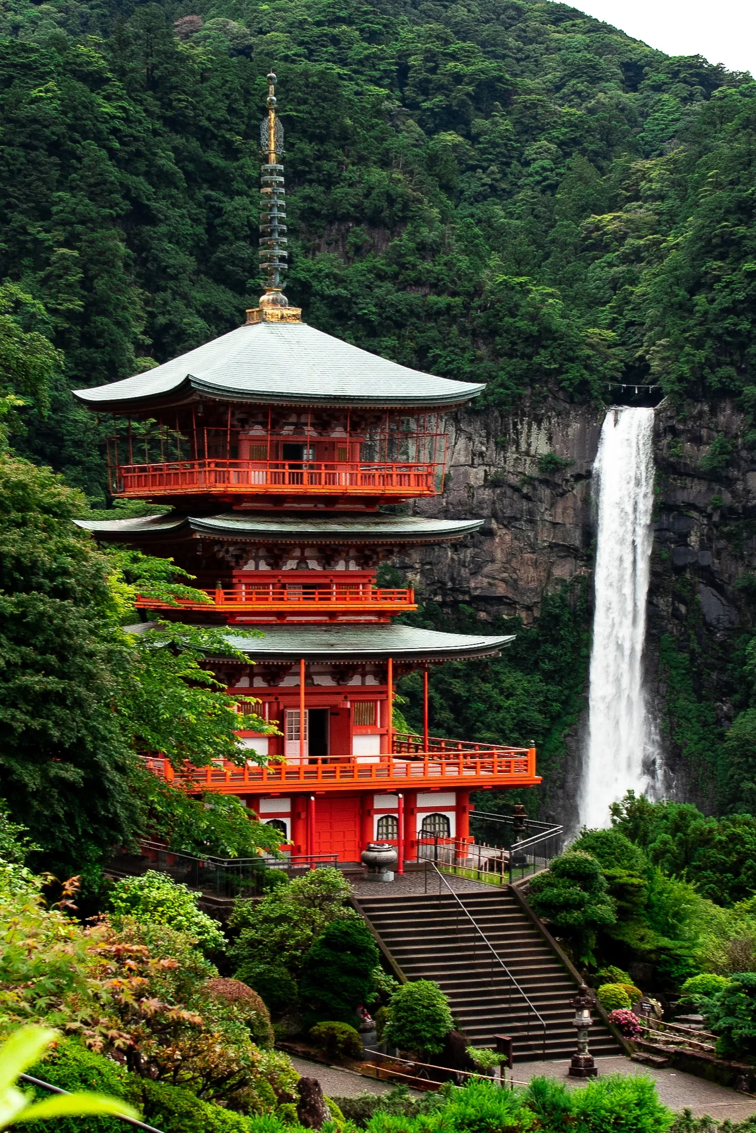
Kumano Nachi Taisha
At the end of the sacred Kumano Kodo pilgrimage route, you'll find Seiganto-ji Temple's three-story pagoda with Nachi Falls (Japan's tallest waterfall at 133 meters) thundering in the background. It's a powerful combination of architecture and nature. As I saw and just took in the waterfall at this photo spot, I felt as if time and space had stopped just for me to enjoy this view.
PRO PHOTO TIP: Use a telephoto lens (70-200mm) to compress the pagoda and the waterfall, making them appear closer and grander.
GPS Coordinates: 33.6715° N, 135.8890° E
Address: Nachisan, Nachikatsuura, Higashimuro District, Wakayama 649-5301, Japan
How to Get There: From Kii-Katsuura Station, take a 30-minute bus bound for "Nachi-san" and get off at the "Nachi-san" (shrine) stop.
Cost: Free for the grounds
Best Time to Shoot: Early morning after a rainfall to ensure the waterfall is at its most powerful.
Website: https://kumanonachitaisha.or.jp/
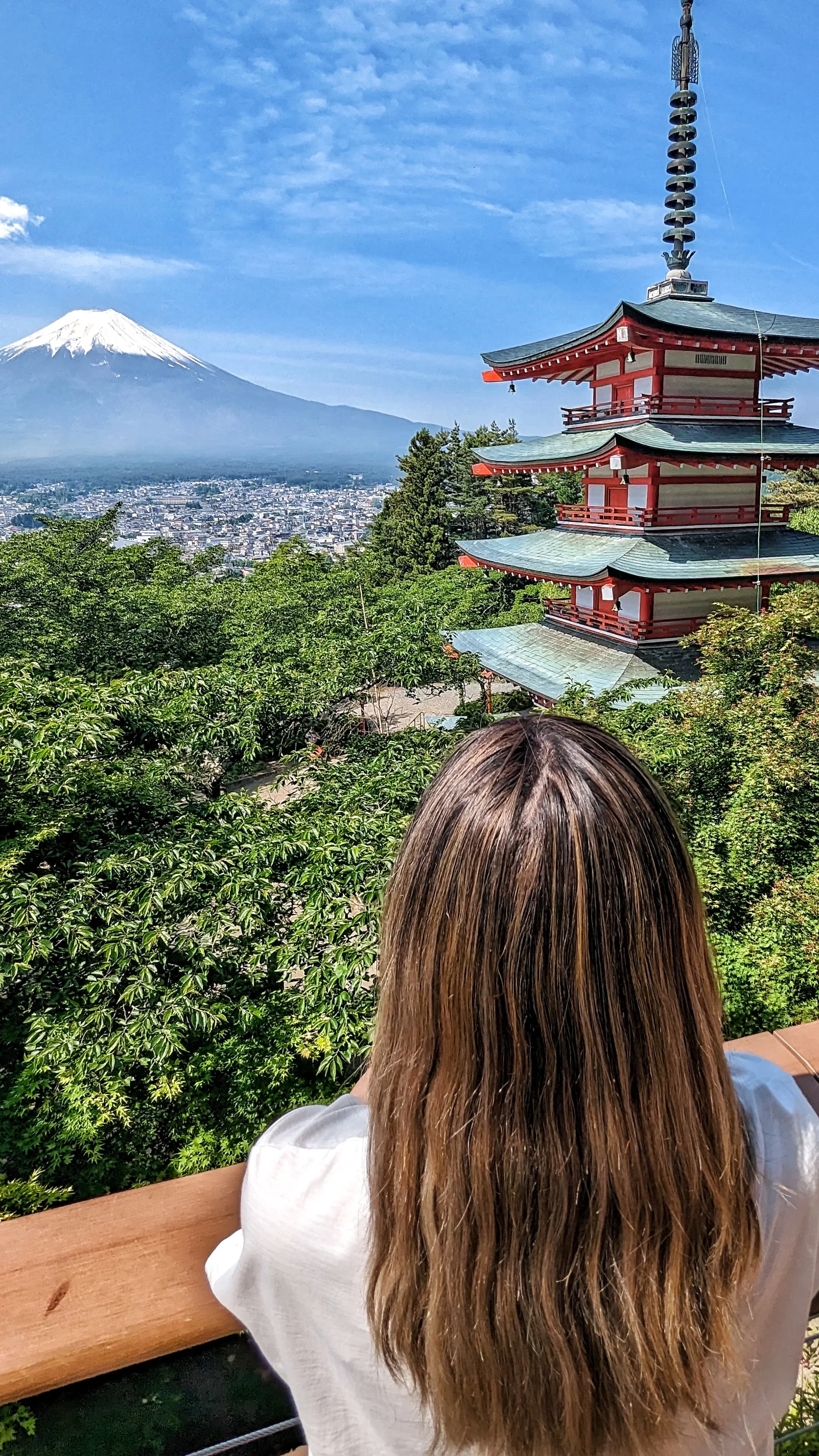
Chureito Pagoda
This is probably the most iconic Japan photograph you've ever seen: a five-story red pagoda with Mount Fuji perfectly framed behind it. The 400-step climb is totally worth it.
The viewing platform sits behind the pagoda and gives you the classic shot everyone comes for.
PRO PHOTO TIP: This spot is all about the season. Go during peak cherry blossom season (usually early-mid April) for the ultimate shot. Sunrise is best to beat the crowds and get soft light on Mount Fuji.
GPS Coordinates: 35.4965° N, 138.7997° E
Address: 2-chome-4-1 Asama, Fujiyoshida, Yamanashi 403-0011, Japan
How to Get There: From Tokyo, take a train (JR Chuo Line or Fujikyu Railway) to Shimo-Yoshida Station. From there, it's a 20-minute walk to the base of the hill.
Cost: Free
Best Time to Shoot: Sunrise during cherry blossom season or for autumn colors.
Website: https://chureito-pagoda.com/
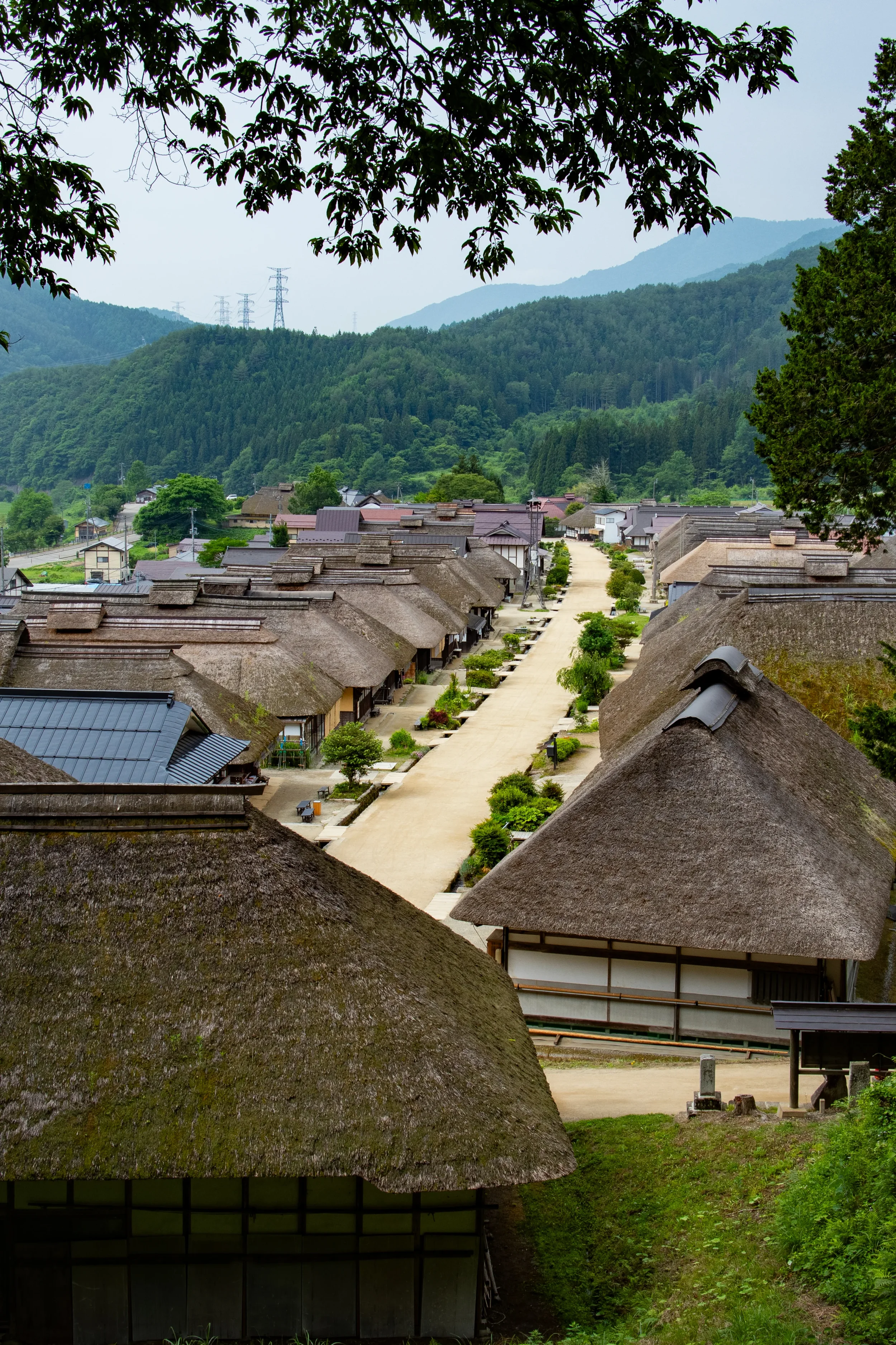
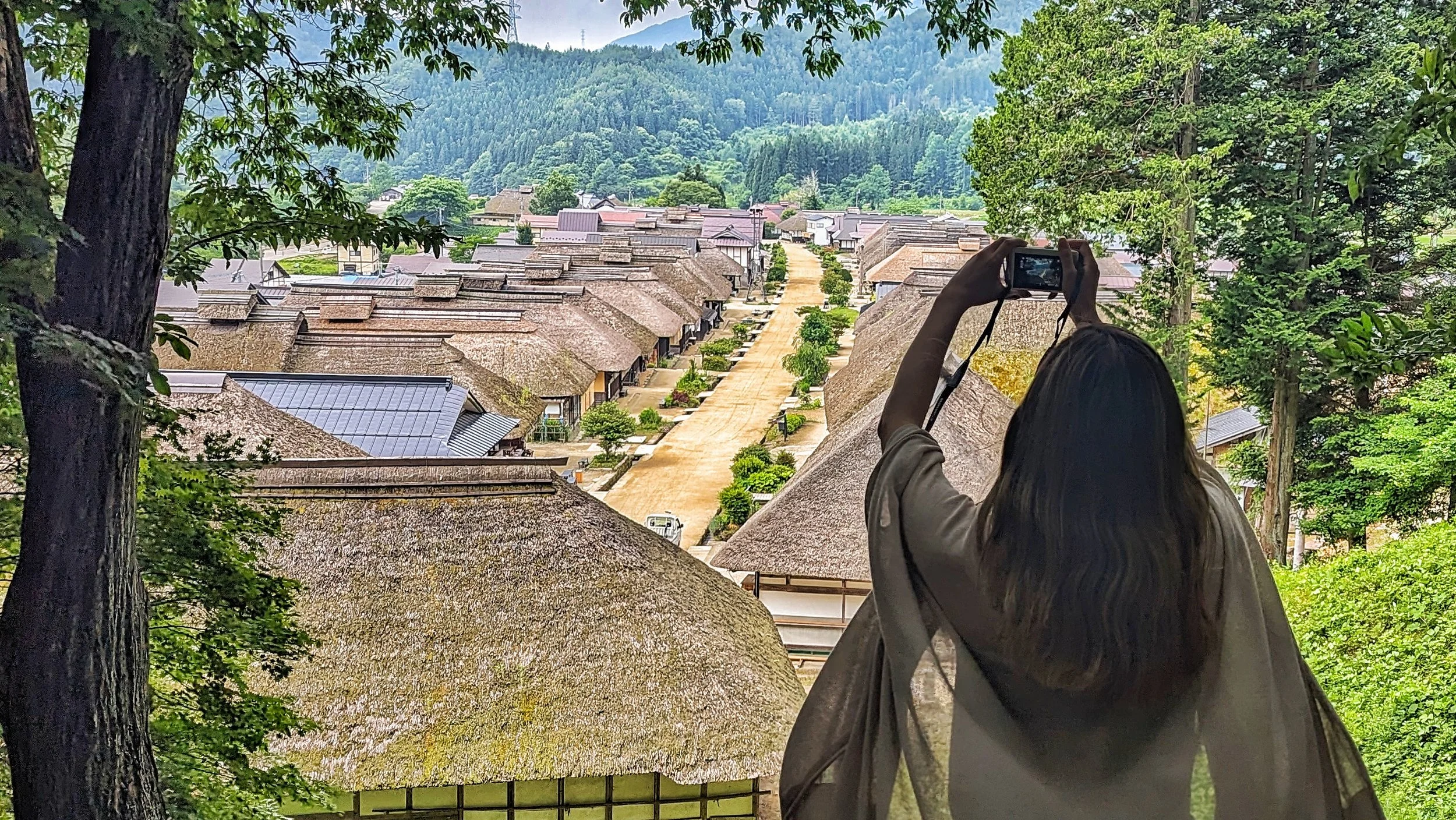
Ouchi juku
Time moves differently in Ouchijuku. The Edo period post town sits cradled in mountains, its thatched-roof houses lined up along a single street like something out of a half-remembered dream.
I climbed the small hill to Komyoji Temple in the early morning, before the shops opened, before the modern world woke up. From that vantage point, the whole village spread below me, and I felt the strange vertigo of displacement—not in space, but in time. Some places are portals. You just have to be quiet enough to step through.
PRO PHOTO TIP: Walk to the end of the main street and climb the small hill to get a iconic overview shot of the entire village.
GPS Coordinates: 37.3375° N, 139.8665° E
Address: Ouchi, Shimogo, Minamiaizu District, Fukushima 969-5207, Japan
How to Get There: Take the Aizu Railway to Yunokami-Onsen Station. From there, it's a 15-minute taxi ride or a seasonal "Saruyugo" bus.
Cost: Free
Best Time to Shoot: Early morning before the shops open (around 8 AM) to get the street empty.
Website: http://ouchi-juku.com/

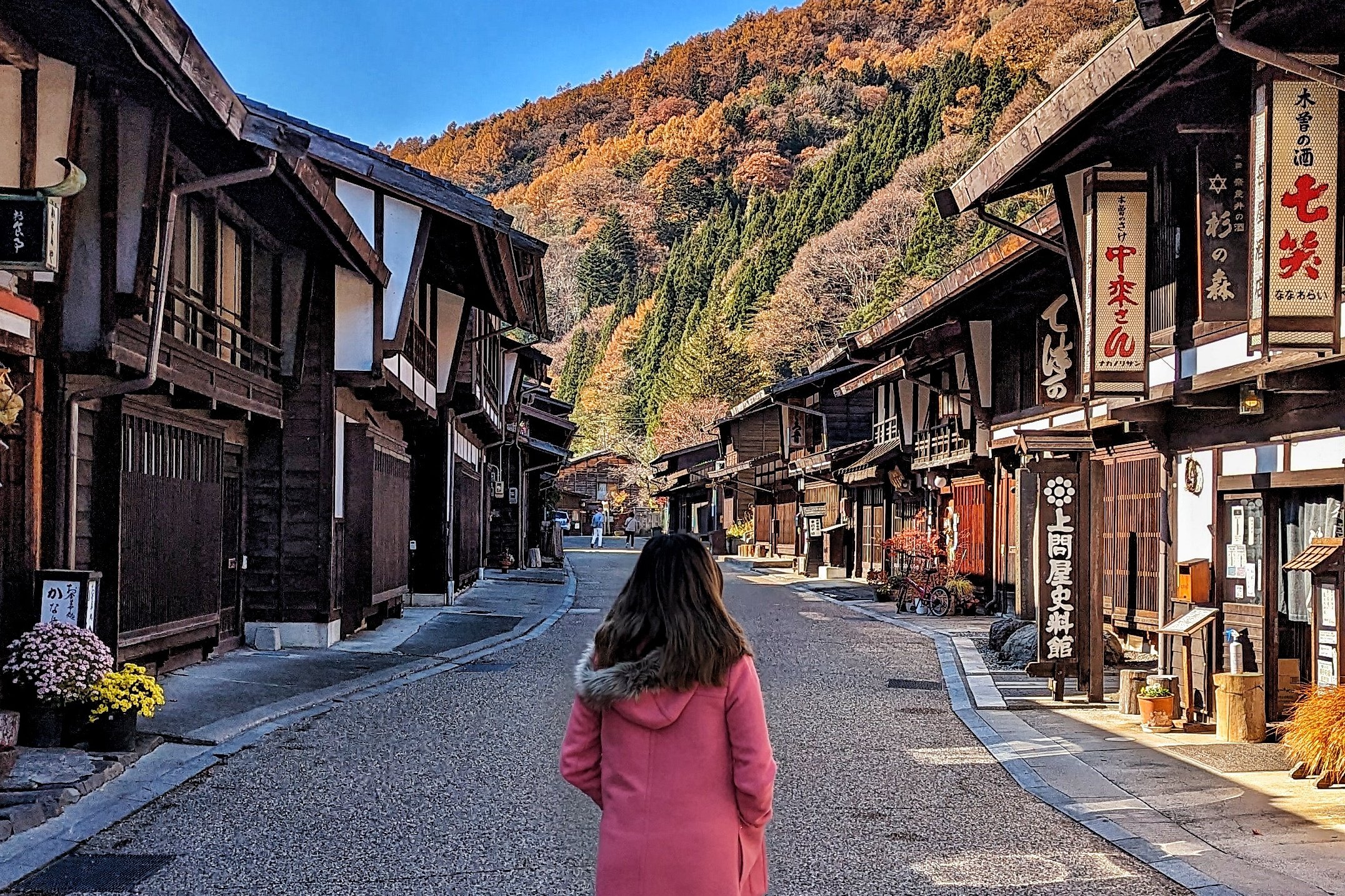
Narai juku
Known as "Narai of a Thousand Houses," this was the wealthiest post town on the Kiso Valley's Nakasendo Trail.
It's the longest preserved post town in Japan, and its dark wood buildings create an incredibly atmospheric scene that stretches down a single street.
PRO PHOTO TIP: This town is all about leading lines. Shoot from one end of the street using a mid-range lens to capture the sense of scale.
GPS Coordinates: 35.9657° N, 137.8188° E
Address: Narai, Shiojiri, Nagano 399-6303, Japan
How to Get There: This is one of the easiest post towns to access. Take the JR Chuo Line to Narai Station. The town is a 3-minute walk away.
Cost: Free
Best Time to Shoot: Blue hour or early morning.
Website: https://www.naraijuku.com/
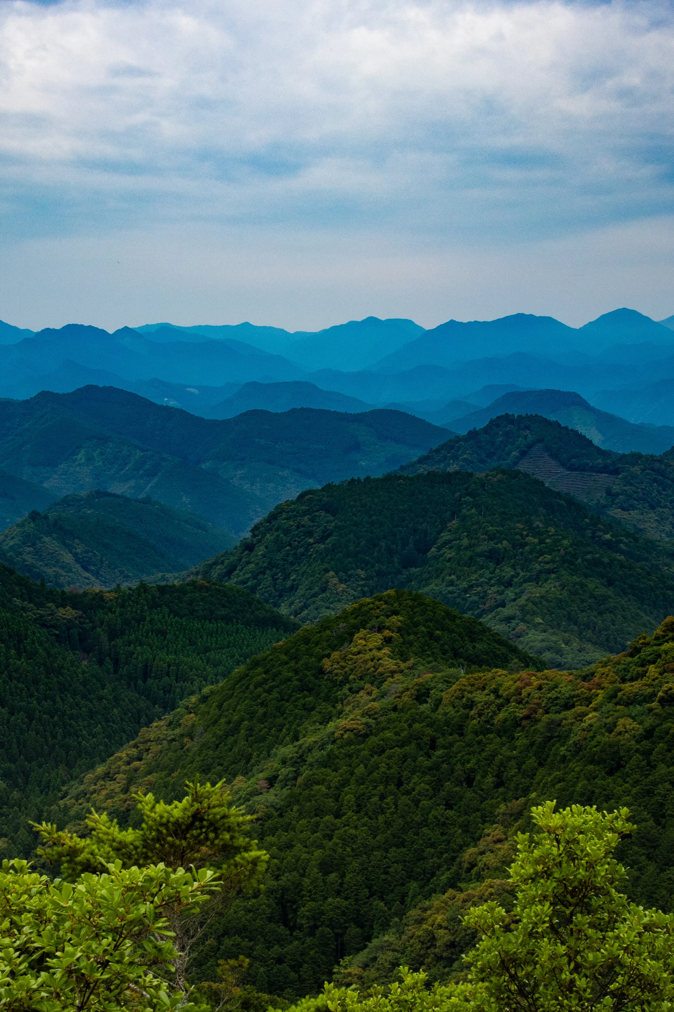
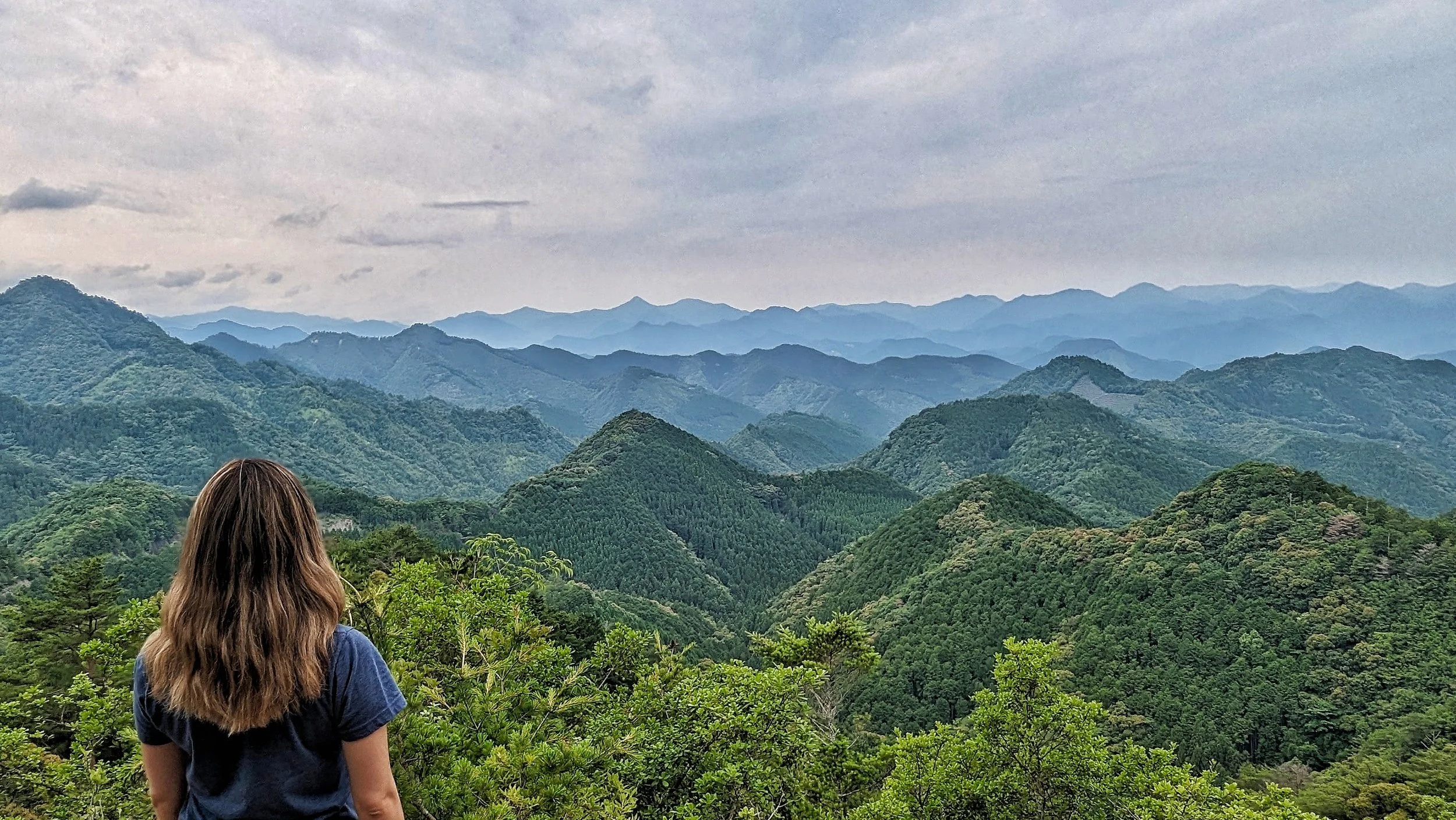
Hyakken gura Viewpoint —Kumano Kodo
This viewpoint on the challenging Ogumo-tori goe section of the Nakahechi route offers breathtaking 360-degree panoramic views of the Kii Mountains. It's the ruins of an old tea house, and the layered mountain ridges stretching to the horizon are incredible.
PRO PHOTO TIP: Use a wide-angle lens (16-35mm) to capture the sheer scale of the layered mountains. This spot is magical at sunrise or golden hour, as the light hits the endless ridges.
GPS Coordinates: 33.7226° N, 135.8155° E
Address: Ogumo-tori goe Trail, Hongu, Tanabe, Wakayama 646-1435, Japan
How to Get There: There is no way to get here other than to hike. It takes about 4 hours to hike to this viewpoint, and then another 4 hours to hike to the next destination.
Cost: Free
Best Time to Shoot: Clear day at sunrise or golden hour.

Biei Blue Pond (Aoiike)
This man-made pond is famous for its surreal, milky-blue water caused by natural minerals.
Dead larch trees standing in the water create a hauntingly beautiful, almost otherworldly landscape.
PRO PHOTO TIP: This spot looks best on an overcast day. Bright, direct sunlight washes out the blue color. Long exposures will smooth the water, making it look even more mystical.
GPS Coordinates: 43.4984° N, 142.6105° E
Address: Shirogane, Biei, Kamikawa District, Hokkaido 071-0235, Japan
How to Get There: From Biei Station, it's a 25-minute drive or a ride on the Dohoku Bus bound for Shirogane Onsen. But best to rent a car and drive.
Cost: Free (parking fee may apply)
Best Time to Shoot: An overcast day, or in winter when it's frozen and illuminated at night.
Website: https://biei-shirogane.jp/

Fushimi Inari Taisha
Yes, it's one of the most popular "Instagrammable" spots in Japan, and for good reason. Those thousands of vibrant red torii gates winding up the mountainside are genuinely mesmerizing. The tunnel effect as you walk through them is unlike anything else.
PRO PHOTO TIP: You MUST go at sunrise (think 6 AM). The tunnels shown here are most crammed in the beginning. It’s more spaced out the further up you go.
GPS Coordinates: 34.9671° N, 135.7727° E
Address: 68 Fukakusa Yabunouchicho, Fushimi Ward, Kyoto, 612-0882, Japan
How to Get There: From Kyoto Station, take the JR Nara Line (2 stops, 5 mins) to Inari Station. The main shrine entrance is directly across the street.
Cost: Free
Best Time to Shoot: Sunrise (6 AM - 7 AM).
Website: http://inari.jp/en/
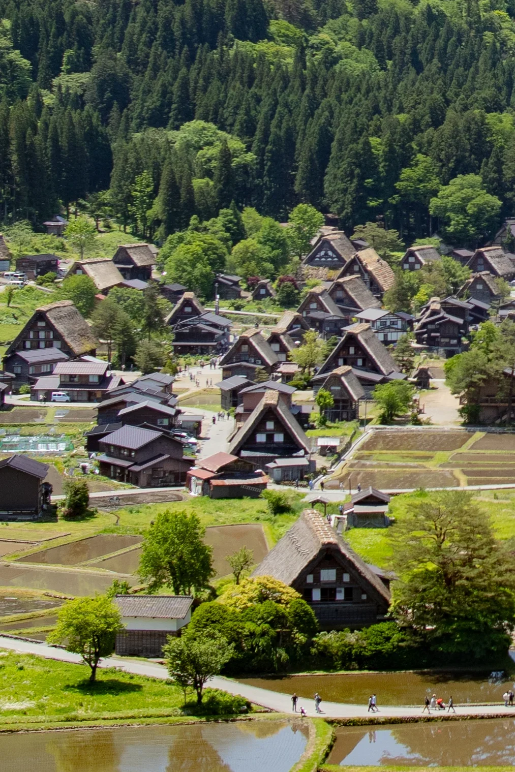
Shirakawago (Ogimachi Village)
This UNESCO World Heritage site is famous for its traditional gassho-zukuri farmhouses with steep thatched roofs designed to handle heavy snow.
The whole village looks like something from a storybook.
PRO PHOTO TIP: The best photo is not from within the village, but from the Ogimachi Castle Viewpoint overlooking it. You can walk up (20 min) or take a shuttle bus.
GPS Coordinates (Viewpoint): 36.2606° N, 136.9056° E
Address: Ogimachi, Shirakawa, Ono District, Gifu 501-5627, Japan
How to Get There: This village is best reached by bus. Take a Nohi Bus from Takayama (50 mins) or Kanazawa (75 mins).
Cost: Free
Best Time to Shoot: During the special winter illumination events or in spring with the rice paddies.
Website: https://shirakawa-go.gr.jp/en/
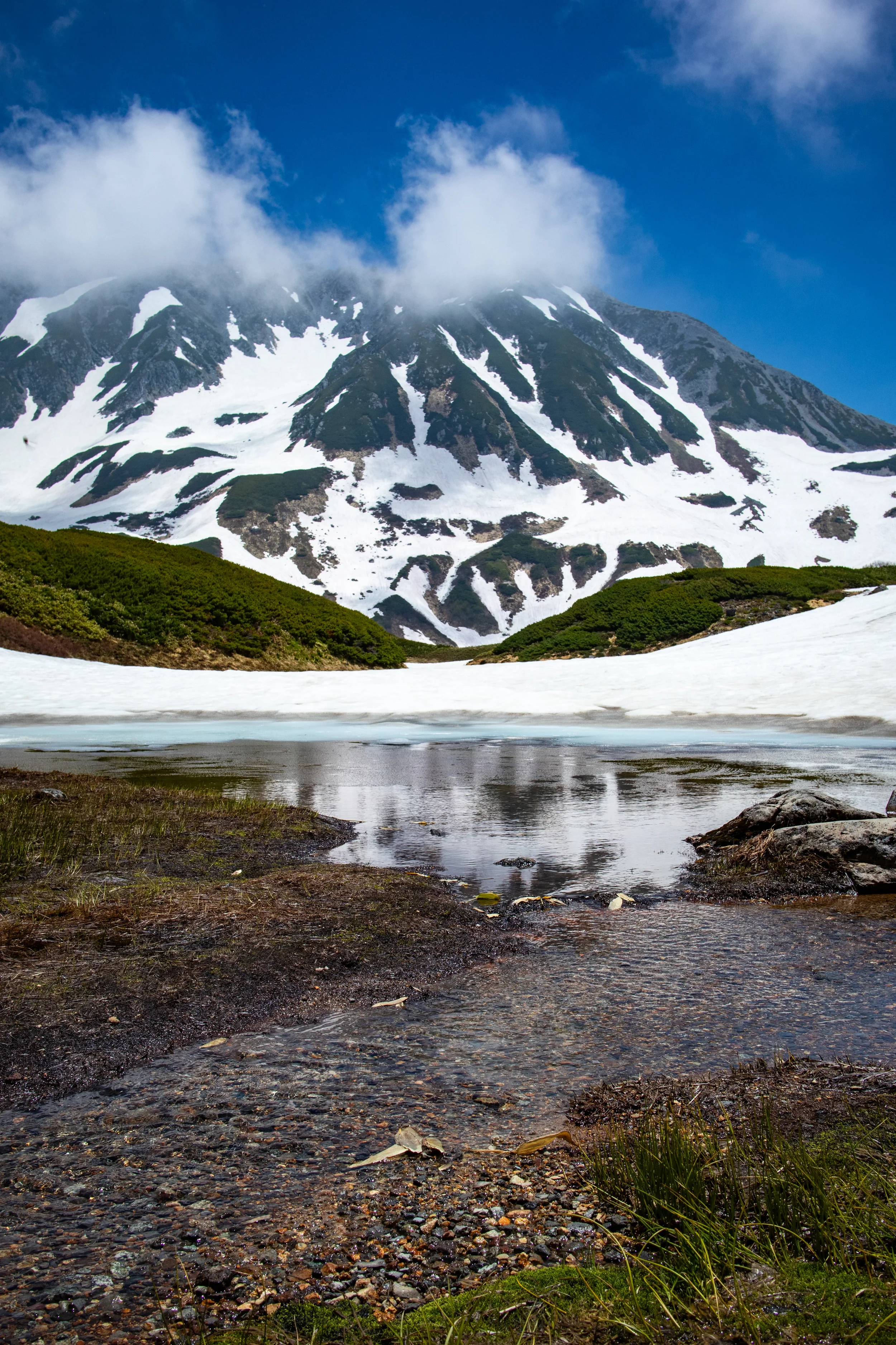
Tateyama Kurobe Alpine Route (Murodo & Kurobe Dam)
This is less a single spot and more an epic 90km journey across the Northern Japan Alps, known as the "Roof of Japan." It’s an engineering marvel you traverse using cable cars, trolley buses, and ropeways. The two must-photograph stops are Murodo and the Kurobe Dam.
Murodo: Seeing the snowy mountains here (pictured) are one of the most beautiful sights I’ve ever come across.
Kurobe Dam: An immense, 186m high dam. From late June to mid-October, you can photograph the spectacular daily water discharge, which releases 10-15 tons of water per second, often creating a rainbow.
PRO PHOTO TIP: For the snow wall, use a wide-angle lens and a person for scale. For the dam, shoot from the observation deck to capture the scale and the rainbow in the mist.
GPS Coordinates: 36.5700° N, 137.6000° E
Address: Tateyama, Nakaniikawa District, Toyama 930-1406, Japan
How to Get There: You must start from one end. Either Tateyama Station (Toyama side) or Ogizawa Station (Nagano side). You cannot drive the route.
Cost: Expensive. The full route ticket costs over 10,000 JPY.
Best Time to Shoot: Mid-April to late May for the snow wall; late June to mid-October for the dam discharge.
Website: https://www.alpen-route.com/en/

Byodo-in Temple (Phoenix Hall)
You might recognize this temple—it's the one on the 10-yen coin!
The Phoenix Hall is an elegant, beautiful example of Heian period architecture, and it creates a perfect reflection in the Aji-ike Pond.
PRO PHOTO TIP: The classic shot is from across the pond, capturing the full temple and its reflection. A polarizing filter will help cut glare and make the reflection even clearer.
GPS Coordinates: 34.8920° N, 135.8080° E
Address: 116 Uji Renge, Uji, Kyoto 611-0021, Japan
How to Get There: From Kyoto Station, take the JR Nara Line to Uji Station (about 20-30 mins). From there, it's a 10-minute walk.
Cost: 600 JPY
Best Time to Shoot: Morning, when the light is on the front of the temple and the pond is still.
Website: https://www.byodoin.or.jp/en/
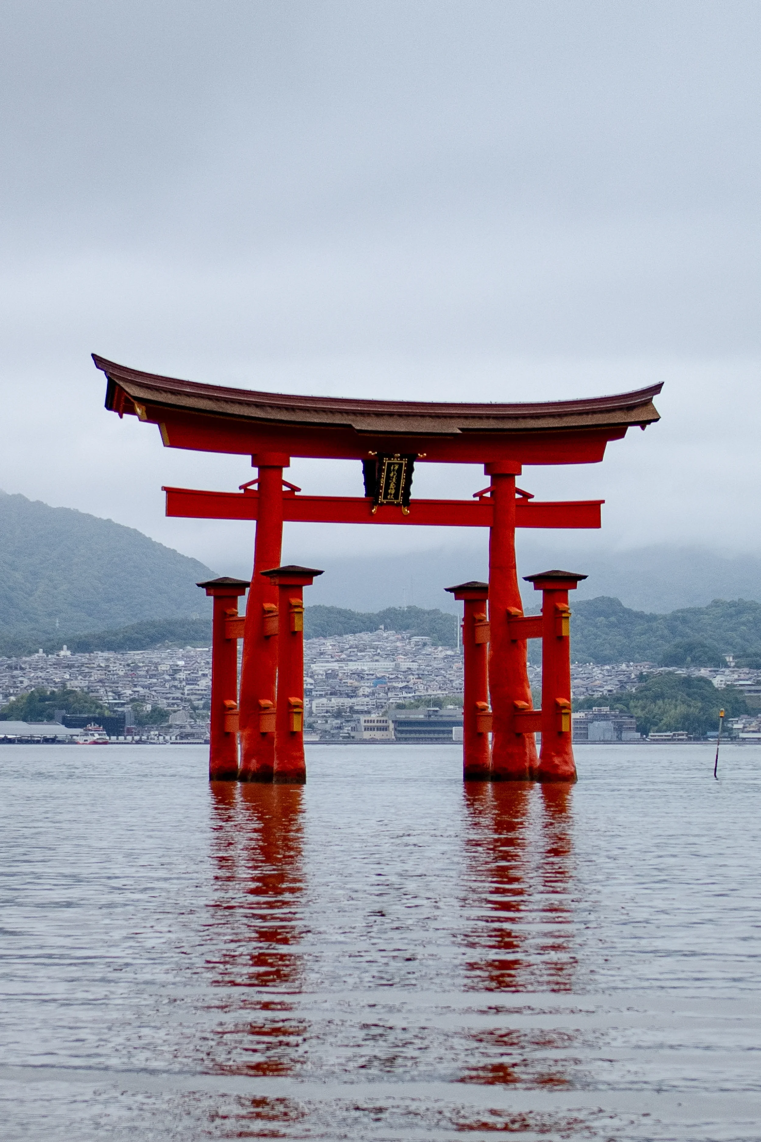
Miyajima (Itsukushima Shrine)
This "floating" torii gate is one of Japan's most recognizable symbols.
At high tide, the entire shrine complex and its massive red gate appear to float on the sea.
At low tide, you can walk right out to the gate on the sand. It's a truly magical place.
PRO PHOTO TIP: You need to check the tide tables! Go at high tide (for the floating shot) and low tide (to walk out to the gate).
GPS Coordinates: 34.2959° N, 132.3193° E
Address: 1-1 Miyajimacho, Hatsukaichi, Hiroshima 739-0588, Japan
How to Get There: From Hiroshima Station, take the JR Sanyo Line to Miyajimaguchi Station (25 mins).Walk 5 mins to the JR ferry pier for the 10-min ferry ride (covered by JR Pass).
Cost: Shrine entrance 300 JPY (viewing the gate is free)
Best Time to Shoot: High tide at sunset.
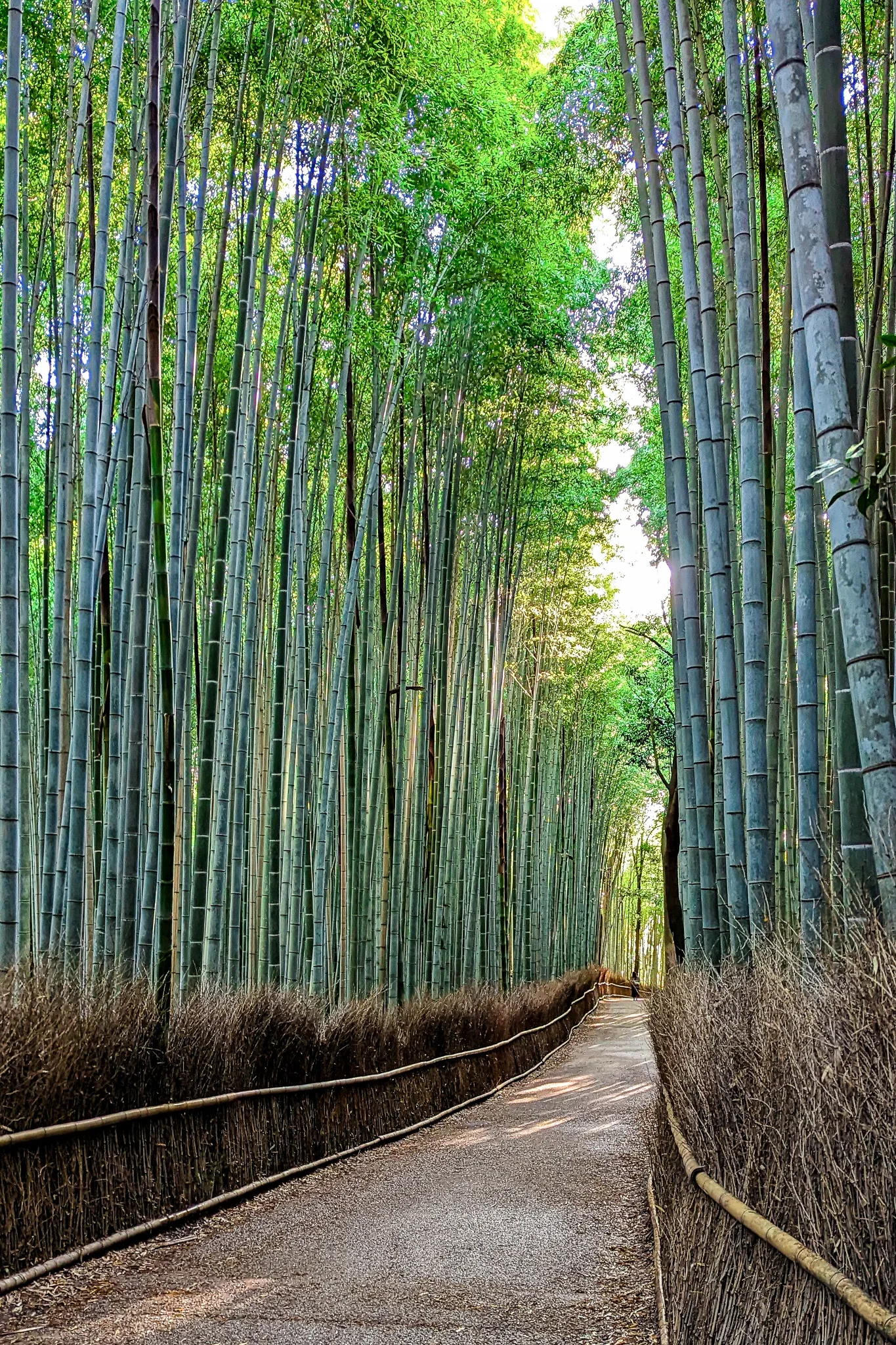
Arashiyama Bamboo Grove, Kyoto
Walking through this grove is an otherworldly experience.
The towering bamboo stalks create a dense, green canopy that seems to filter the light and sound from the outside world.
The path that winds through it is one of the most famous (and crowded) in Japan.
PRO PHOTO TIP: Same as Fushimi Inari: GO AT SUNRISE. It's a nightmare of crowds otherwise. Look up and use a wide-angle lens to capture the canopy.
GPS Coordinates: 35.0173° N, 135.6737° E
Address: Sagaogurayama Tabuchiyamacho, Ukyo Ward, Kyoto, 616-8394, Japan
How to Get There: From Kyoto Station, take the JR Sagano Line to Saga-Arashiyama Station (15 mins). The grove is a 10-minute walk from there.
Cost: Free
Best Time to Shoot: Sunrise (6-7 AM).
Website: https://kyoto.travel/en/
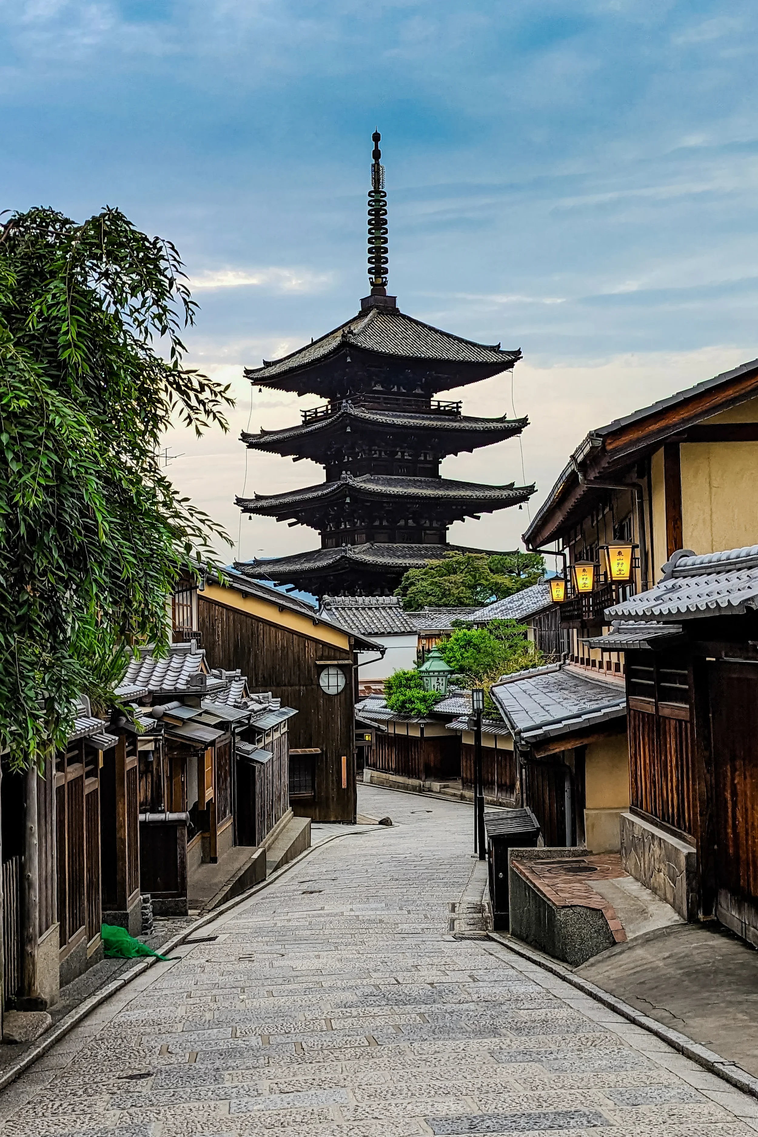
Gion District (Yasaka Pagoda), Kyoto
This is the classic Kyoto shot. The five-story Yasaka Pagoda (Hokan-ji Temple) rises up at the end of a narrow, sloping street lined with traditional wooden machiya houses. It's the heart of the historic Gion district, and it's pure magic at dusk.
PRO PHOTO TIP: This spot is essential at blue hour. Use a tripod and a slow shutter speed to capture the glowing lanterns and light trails from taxis, all with the pagoda lit up in the background.
GPS Coordinates (Iconic Street View): 35.0016° N, 135.7787° E
Address: 388 Yasaka Kamimachi, Higashiyama Ward, Kyoto, 605-0827, Japan
How to Get There: From Kyoto Station, take bus 100 or 206 to the "Kiyomizu-michi" stop. Alternatively, take a train to Gion-Shijo Station and walk 15 minutes.
Cost: Free (street view)
Best Time to Shoot: Blue hour (just after sunset).
Website: https://www.yasaka-no-to.com/

Eiheiji Temple, Fukui
This isn't just a temple; it's one of the head temples of Zen Buddhism and a massive, active monastery. Set in a dense, ancient cedar forest, the complex is a maze of over 70 buildings connected by long, dark wooden corridors, polished by time and the elements.
It's an incredibly atmospheric and spiritual place.
PRO PHOTO TIP: Focus on the atmosphere. Capture the monks in training, the long wooden corridors, and the mossy stone lanterns. Be respectful and quiet.
GPS Coordinates: 36.0593° N, 136.3533° E
Address: 5-15 Shihi, Eiheiji, Yoshida District, Fukui 910-1228, Japan
How to Get There: From Fukui Station, take the Echizen Railway to Eiheiji-guchi Station, then a 15-min "Kyofuku" bus to the temple.
Cost: 500 JPY
Best Time to Shoot: A rainy or misty day to enhance the moody atmosphere.
Website: https://daihonzan-eiheiji.com/en/

Noboribetsu (Jigokudani "Hell Valley")
This is a truly dramatic, almost primal landscape. Jigokudani is a geothermal caldera, a vast expanse of rust-colored rock, steam vents, and bubbling sulfuric streams. A network of wooden boardwalks lets you walk right through this "hellish" and otherworldly valley.
PRO PHOTO TIP: Use the steam to your advantage. Frame your shot so the rising steam creates a moody, atmospheric backdrop.
GPS Coordinates: 42.4975° N, 141.1455° E
Address: Noboribetsu Onsencho, Noboribetsu, Hokkaido 059-0551, Japan
How to Get There: From Noboribetsu Station, take a 15-minute bus to the Noboribetsu Onsen bus terminal. Hell Valley is a 5-minute walk from there.
Cost: Free
Best Time to Shoot: Early morning, when the cool air makes the steam more dramatic.
Website: http://noboribetsu-spa.jp/en/
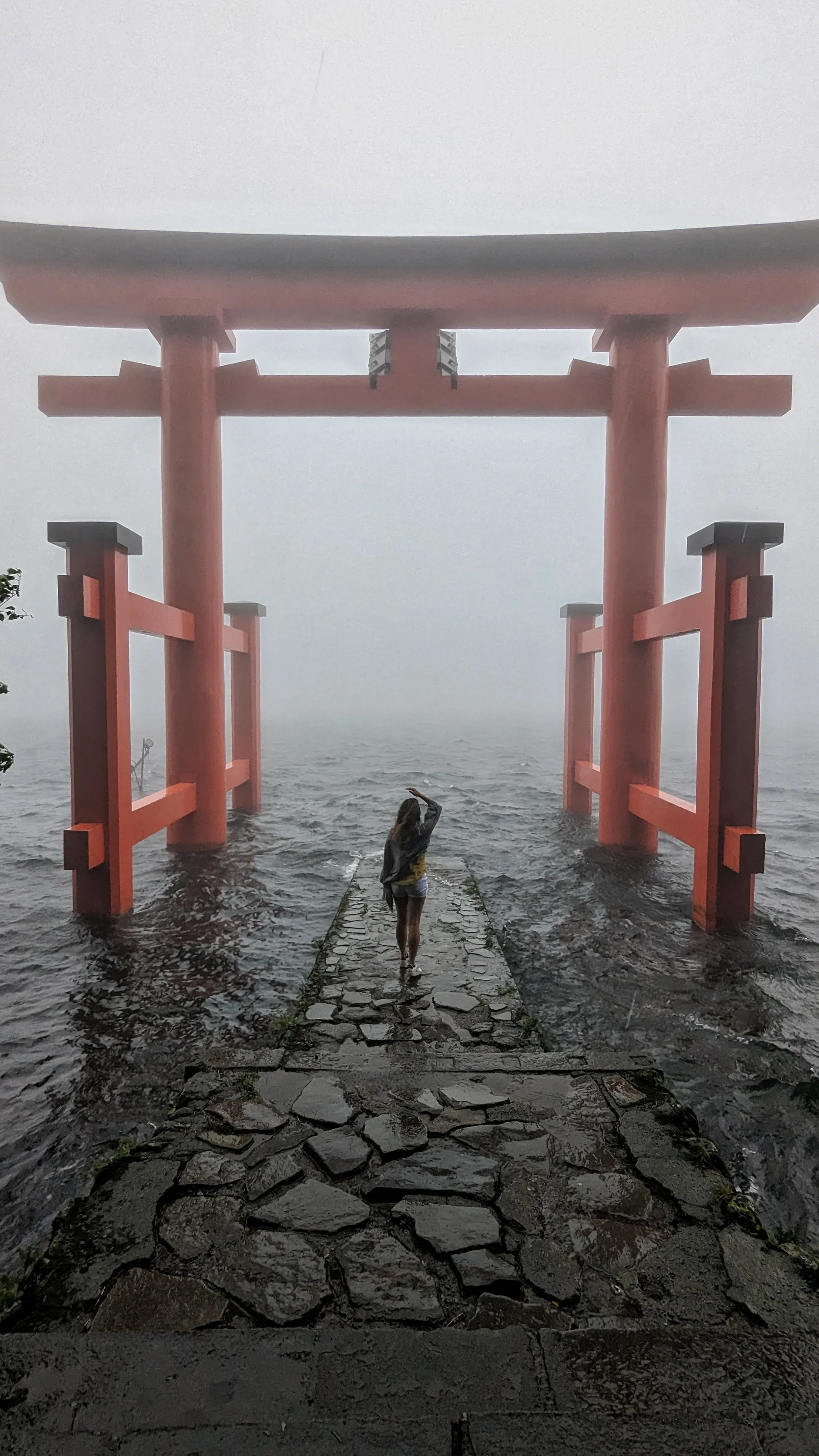
Hakone Shrine (Torii of Peace)
This iconic red torii gate stands majestically in the waters of Lake Ashi, creating a stunning focal point against the water and the forested mountains.
On a clear day, Mount Fuji even makes an appearance in the background. It's a spiritual and incredibly photogenic spot.
PRO PHOTO TIP: The line for this photo is famously long. My tip? Shoot it from the side with a telephoto lens to capture people taking photos, or get creative and frame it from the nearby pier.
GPS Coordinates: 35.2045° N, 139.0264° E
Address: 80-1 Motohakone, Hakone, Ashigarashimo District, Kanagawa 250-0522, Japan
How to Get There: From Hakone-Yumoto Station, take the Hakone Tozan Bus (line H or K) to the "Moto-Hakone" stop (about 35 mins).
Cost: Free
Best Time to Shoot: Early morning (before 8 AM) to beat the queue. I came in the rain and fog and there was still a line.
Website: https://hakonejinja.or.jp/
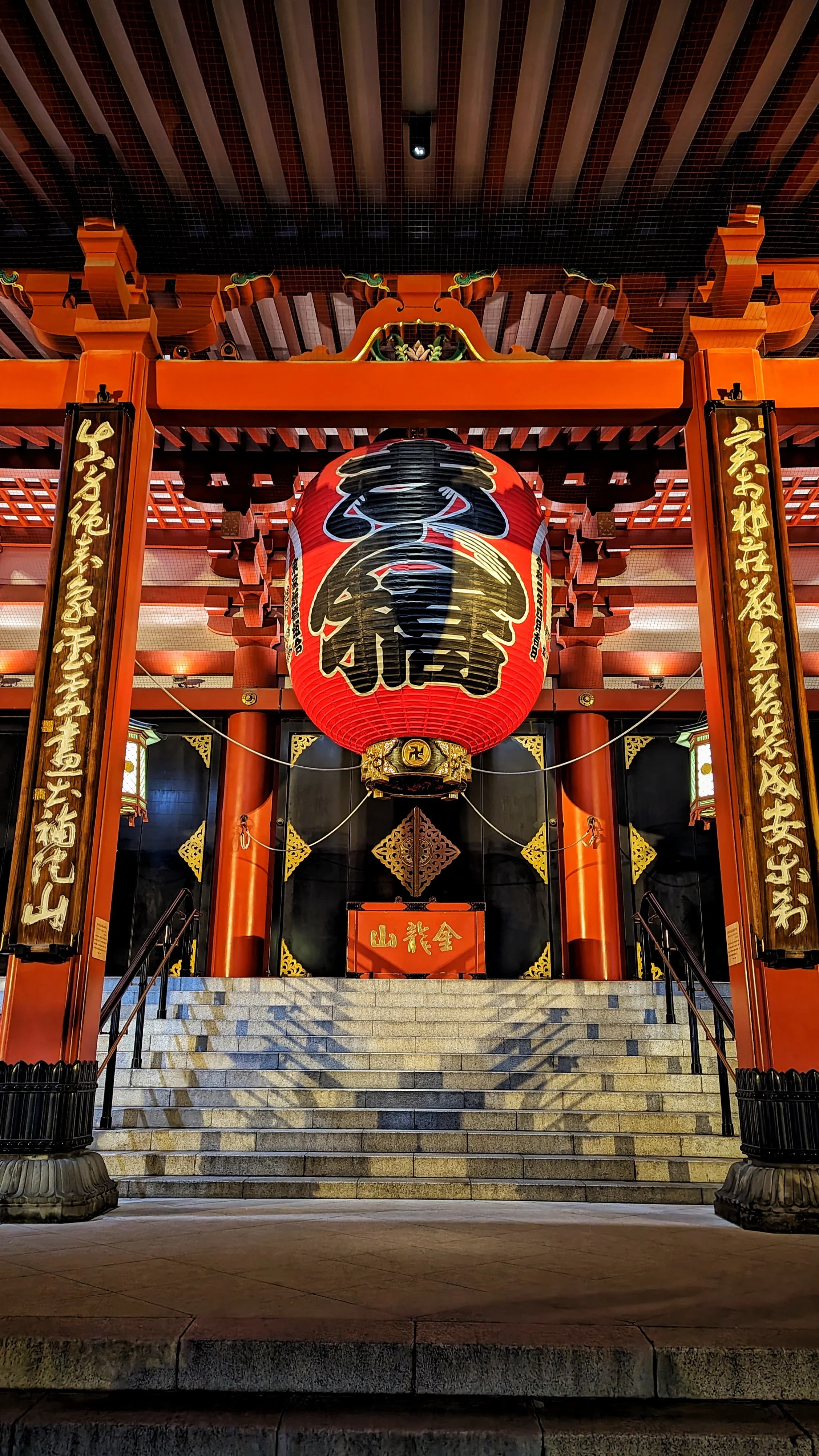
Senso-ji Temple, Tokyo
This is Tokyo's oldest and most significant temple. You enter through the massive Kaminarimon (Thunder Gate) with its giant red lantern, walk down the bustling Nakamise-dori shopping street, and arrive at the temple's main hall and five-story pagoda.
It's a vibrant, powerful, and unmissable piece of old Tokyo.
PRO PHOTO TIP: Go at night. The temple is beautifully illuminated (until 11 PM), and the massive day-time crowds are gone, allowing for clean shots of the gates and pagoda.
GPS Coordinates: 35.7148° N, 139.7967° E
Address: 2 Chome-3-1 Asakusa, Taito City, Tokyo 111-0032, Japan
How to Get There: Take the Tokyo Metro Ginza Line, Toei Asakusa Line, or Tobu Skytree Line to Asakusa Station. It's a 5-minute walk.
Cost: Free
Best Time to Shoot: Sunrise (before 7 AM) or late at night (after 10 PM) for no crowds.
Website: https://www.senso-ji.jp/
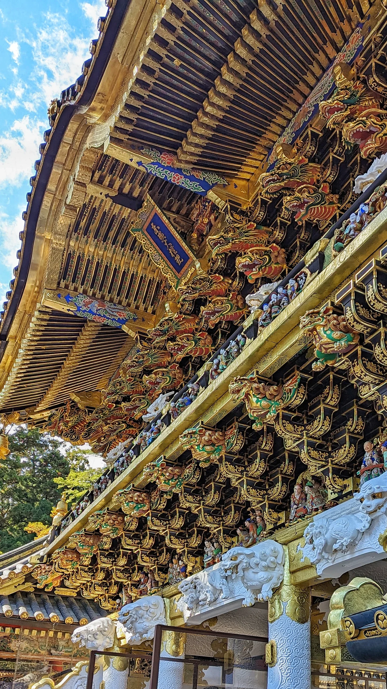
Nikko (Toshogu Shrine)
This isn't your typical minimalist Zen shrine. Toshogu is a World Heritage site and one of the most lavishly decorated religious complexes in Japan, a symphony of gold leaf, intricate carvings, and vibrant colors. It's the final resting place of Tokugawa Ieyasu, founder of the Tokugawa Shogunate.
PRO PHOTO TIP: Focus on the details. The carvings are insane. A polarizing filter is a must to cut the glare on the gold leaf and lacquer.
GPS Coordinates: 36.7574° N, 139.5994° E
Address: 2301 Sannai, Nikko, Tochigi 321-1431, Japan
How to Get There: From Tobu-Nikko or JR Nikko Station, take the World Heritage Meguri Bus (10-15 mins) to the "Omotesando" stop.
Cost: 1,300 JPY (for Toshogu only)
Best Time to Shoot: Early morning on a weekday.
Website: https://www.toshogu.jp/en/

Kanazawa (Higashi Chaya District)
This is Kanazawa's largest and most famous geisha district, and it's absolutely stunning. The streets are lined with beautifully preserved wooden chaya (teahouses) where geisha still entertain guests. It's like a more intimate, less-crowded version of Kyoto's Gion.
PRO PHOTO TIP: Go very early in the morning (around 7 AM) to get the streets completely empty. Stay until dusk (blue hour) to capture the glow of the street lanterns against the dark wood.
GPS Coordinates: 36.5710° N, 136.6660° E
Address: 1 Chome Higashiyama, Kanazawa, Ishikawa 920-0831, Japan
How to Get There: From Kanazawa Station, take the Kanazawa Loop Bus (Right Loop) to the "Hashiba-cho" bus stop (about 10 mins), then walk 5 minutes.
Cost: Free to walk around (some teahouses have entry fees).
Best Time to Shoot: Very early morning (7 AM) or blue hour.
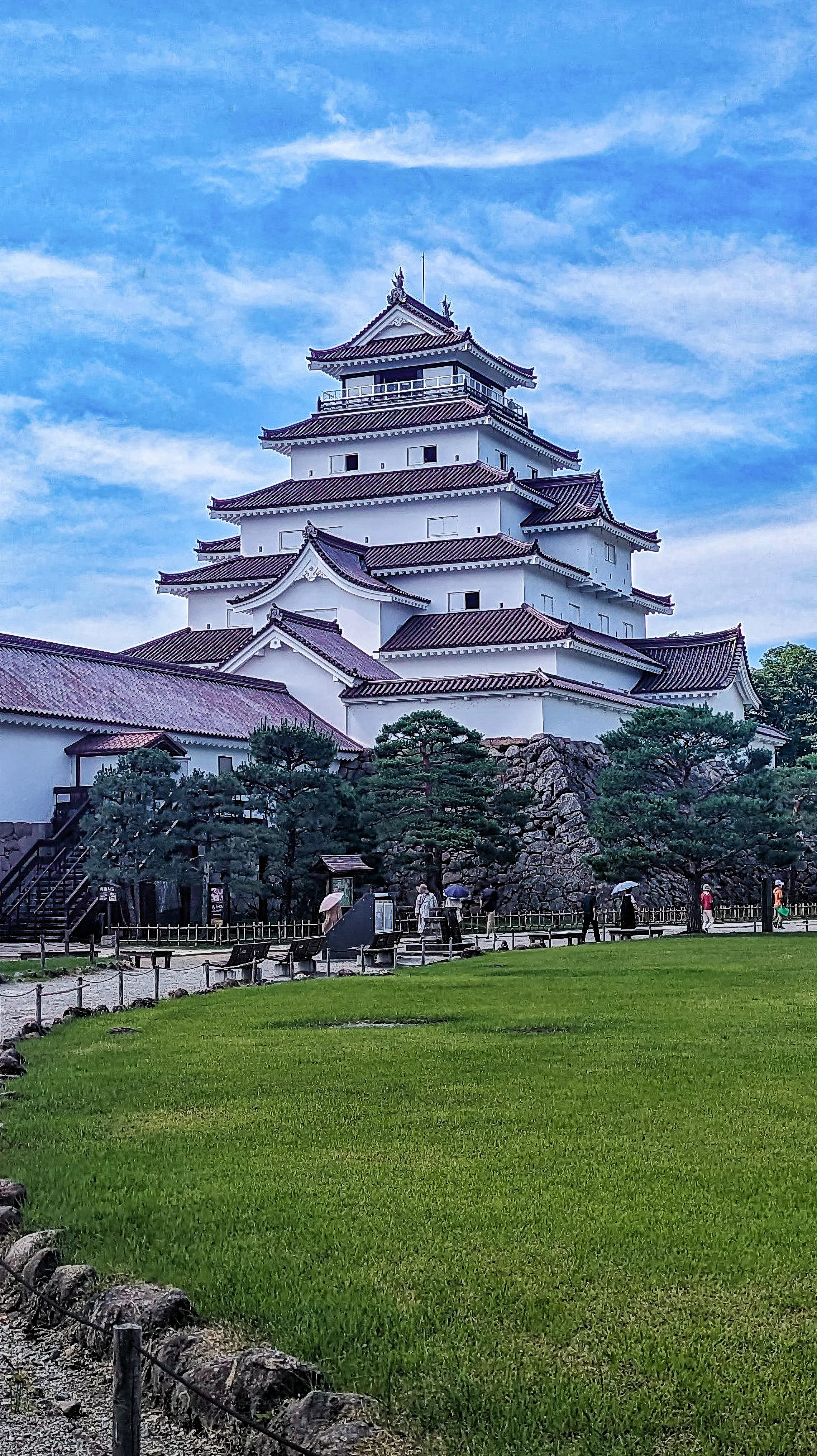
Tsuruga Castle, Aizuwakamatsu
A stunningly beautiful castle, Tsuruga-jo is unique for its red-tiled roof—a feature not seen on other Japanese castles.
The surrounding park is massive, with stone walls and a moat, making for perfect reflections. It's a symbol of samurai resilience in the region.
PRO PHOTO TIP: Frame the castle with cherry blossoms in spring for a classic composition.
GPS Coordinates: 37.4880° N, 139.9298° E
Address: 1-1 Otemachi, Aizuwakamatsu, Fukushima 965-0873, Japan
How to Get There: From Aizu-Wakamatsu Station, take the "Haikara-san" loop bus to the "Tsurugajo Kitaguchi" stop.
Cost: Castle tower entrance fee (around 410 JPY)
Best Time to Shoot: Spring (cherry blossoms) or winter (with snow).
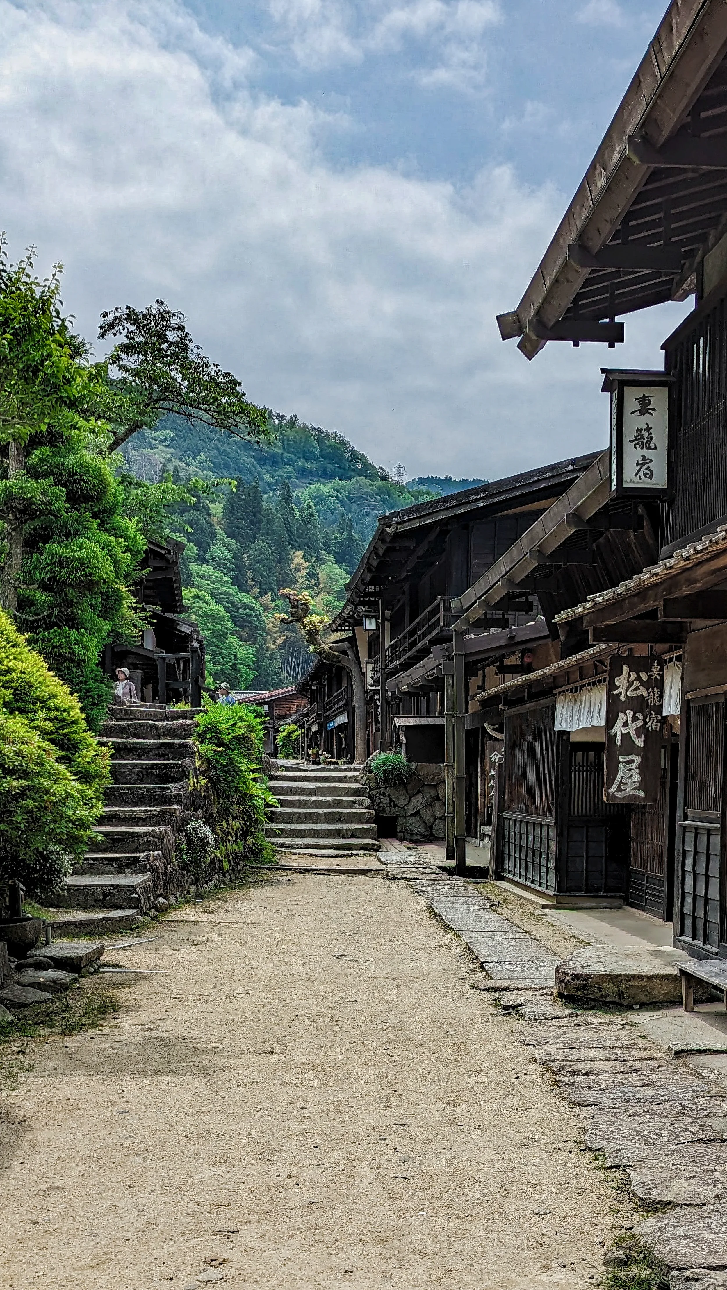
Tsumago & Magome
These are two of the most beautiful and atmospheric post towns on the historic Nakasendo Trail, the old walking route from Kyoto to Edo (Tokyo). The 8km walk between them is one of the best-preserved sections, taking you through forests, past waterfalls, and giving you a true taste of feudal Japan.
PRO PHOTO TIP: Tsumago is generally considered more "authentic" as it's less restored than Magome. Shoot Tsumago in the very early morning light, then hike to Magome and photograph its hilly, winding main street in the afternoon.
GPS Coordinates (Tsumago): 35.5786° N, 137.5956° E
GPS Coordinates (Magome): 35.5259° N, 137.5670° E
How to Get There: To Magome: Take a bus from Nakatsugawa Station. To Tsumago: Take a bus from Nagiso Station. You can hike or take a bus between the two.
Cost: Free
Best Time to Shoot: Very early morning (before 8 AM).
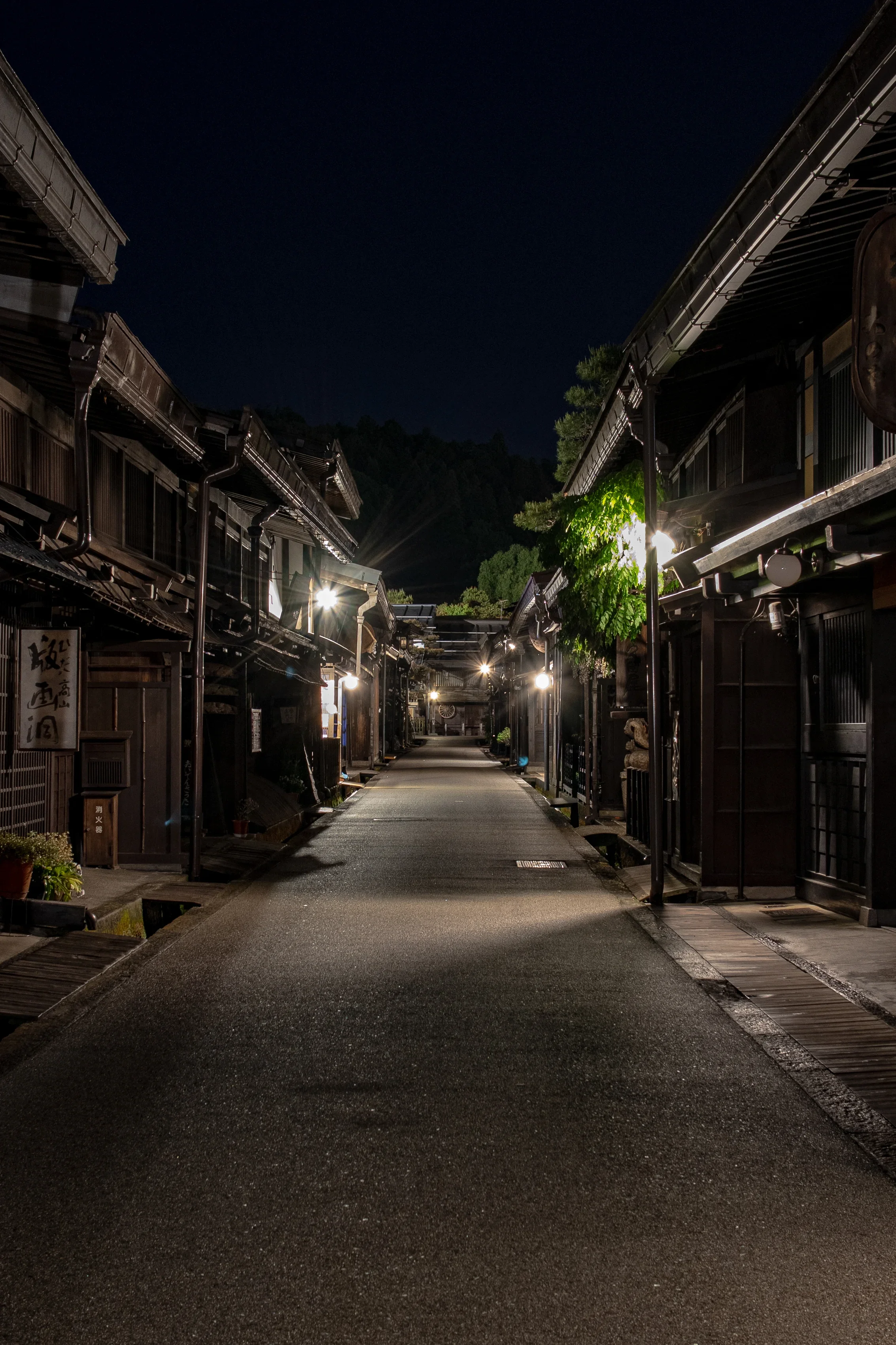
Takayama Old Town (Sanmachi Suji)
This historic district, with its black-wood merchant houses, sake breweries, and morning markets, feels like it was preserved in amber.
The dark, aged wood of the buildings creates an incredible atmosphere and a perfect backdrop for photos.
PRO PHOTO TIP: The dark wood buildings are perfect for portrait backdrops. Shoot in the morning before the crowds arrive.
GPS Coordinates: 36.1437° N, 137.2534° E
Address: Kamisannomachi, Takayama, Gifu 506-0846, Japan
How to Get There: It's a 10-15 minute walk from Takayama Station.
Cost: Free
Best Time to Shoot: Early morning (7-8 AM).
Website: https://www.hidatakayama.or.jp/

Kurobe Gorge Railway
This is an old logging railway turned scenic adventure. The open-air trolley cars weave through the dramatic, V-shaped Kurobe Gorge, one of Japan's deepest, following a brilliant turquoise river.
The ride takes you over dizzying red bridges and through tunnels carved from solid rock.
PRO PHOTO TIP: Sit in an open-air carriage for unobstructed shots. Use a fast shutter speed to avoid motion blur.
GPS Coordinates (Unazuki Station): 36.8041° N, 137.5855° E
Address: Unazuki, Kurobe, Toyama 938-0282, Japan
How to Get There: From Toyama Station, take the Toyama Chiho Railway to Shin-Uozu Station, then transfer to the line for Unazuki Onsen Station, which is next to the gorge railway's Unazuki Station.
Cost: Ticket prices vary depending on how far you go (e.g., ~4,000 JPY round trip to Keyakidaira).
Best Time to Shoot: Peak autumn foliage (late October to mid-November) is spectacular.
Website: https://www.kurotetu.co.jp/en/
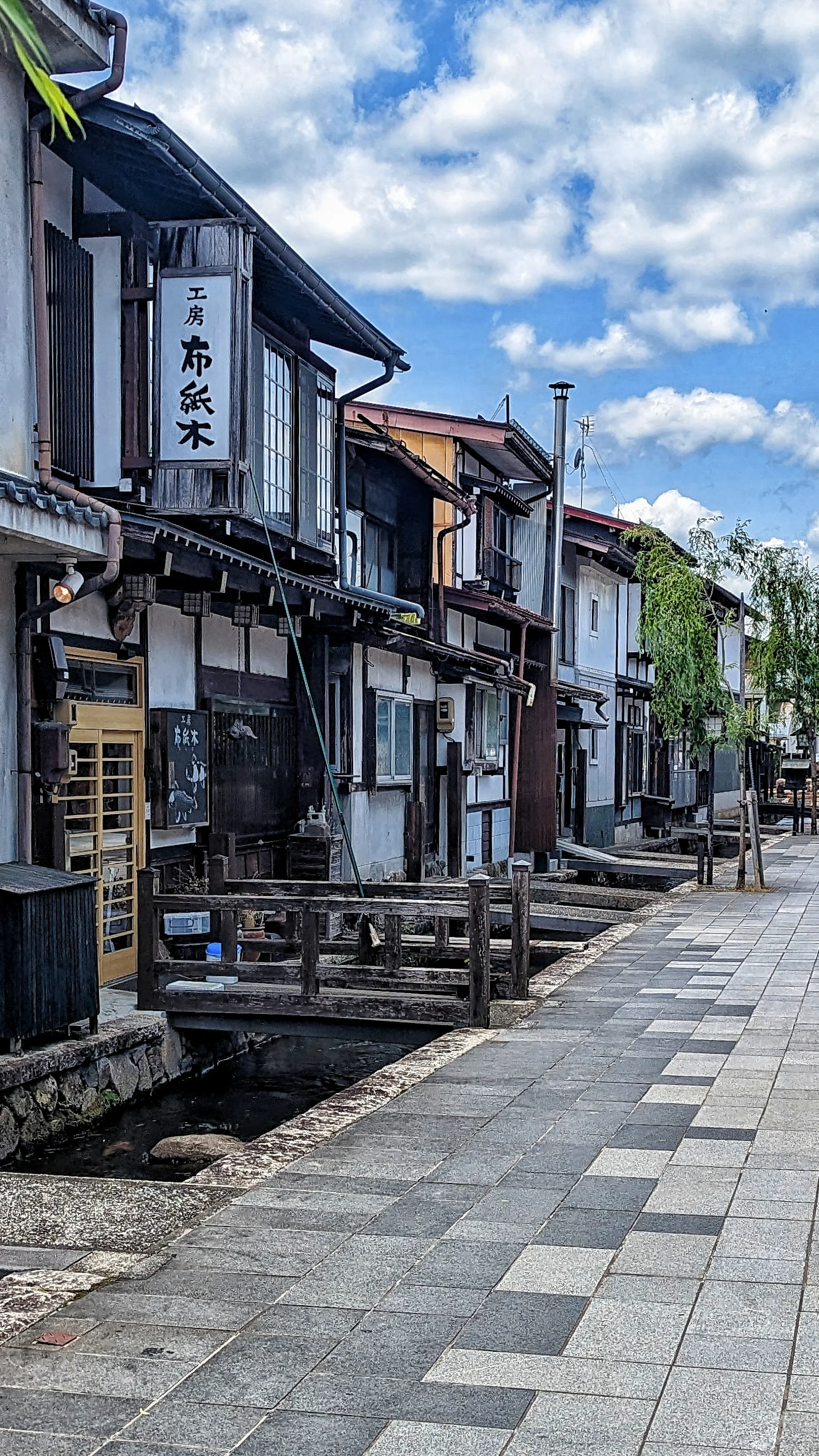
Hida-Furukawa
Just a 15-minute train ride from bustling Takayama, Hida-Furukawa offers a much quieter, more local "Little Kyoto" feel. Its defining feature is the Seto River canal, lined with white-walled storehouses and stone bridges, and famously filled with thousands of colorful koi fish.
PRO PHOTO TIP: Frame the canals with the koi fish in the foreground (they're in the canals from April to November).
GPS Coordinates: 36.2366° N, 137.1856° E
Address: Furukawacho, Hida, Gifu 509-4225, Japan
How to Get There: Easy. From Takayama Station, take the JR Takayama Line one stop north to Hida-Furukawa Station (about 15 mins). The canal is a 5-min walk.
Cost: Free
Best Time to Shoot: Morning, when the light is soft on the canal.
Website: https://www.hida-kankou.jp/

Ohori Park, Fukuoka
An oasis in the city of Fukuoka, this large park is centered on a massive lake. The park's most beautiful feature is a series of bridges that connect three small islands, leading to a charming hexagonal "Ukimido" pavilion that seems to float in the center.
PRO PHOTO TIP: This spot is perfect for long-exposure night photography, capturing the lit-up pavilion and its reflections.
GPS Coordinates: 33.5857° N, 130.3756° E
Address: 1 Ohorikoen, Chuo Ward, Fukuoka, 810-0051, Japan
How to Get There: Take the Fukuoka City Subway Kuko Line to Ohorikoen Station. The park is directly accessible from the station exits.
Cost: Free
Best Time to Shoot: Blue hour or at night.
Website: https://www.ohorikouen.jp/en/
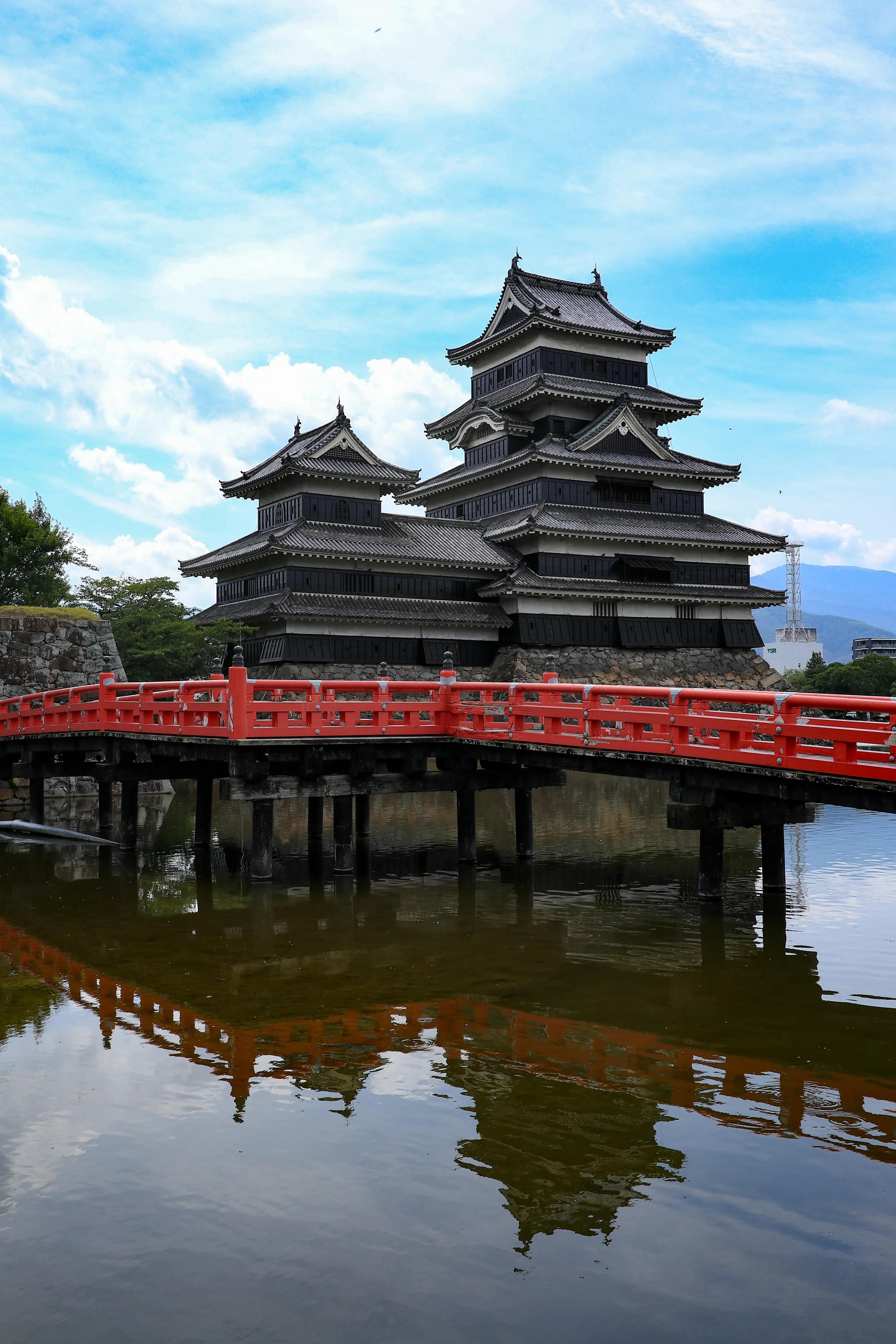
Matsumoto Castle
Known as the "Crow Castle" for its striking black-and-white exterior, this is one of Japan's few remaining original castles. Its beauty is in its authenticity.
Set against the backdrop of the Japanese Alps, the castle's dark form reflects perfectly in the surrounding moat.
PRO PHOTO TIP: The classic shot is from the red Uzumi-bashi bridge, capturing the castle and its reflection in the moat.
GPS Coordinates: 36.2384° N, 137.9691° E
Address: 4-1 Marunouchi, Matsumoto, Nagano 390-0873, Japan
How to Get T<here: It's a 15-20 minute walk from Matsumoto Station, or you can take the "Town Sneaker" loop bus.
Cost: 700 JPY
Best Time to Shoot: Morning, for soft light on the castle face.
Website: https://www.matsumoto-castle.jp/eng/
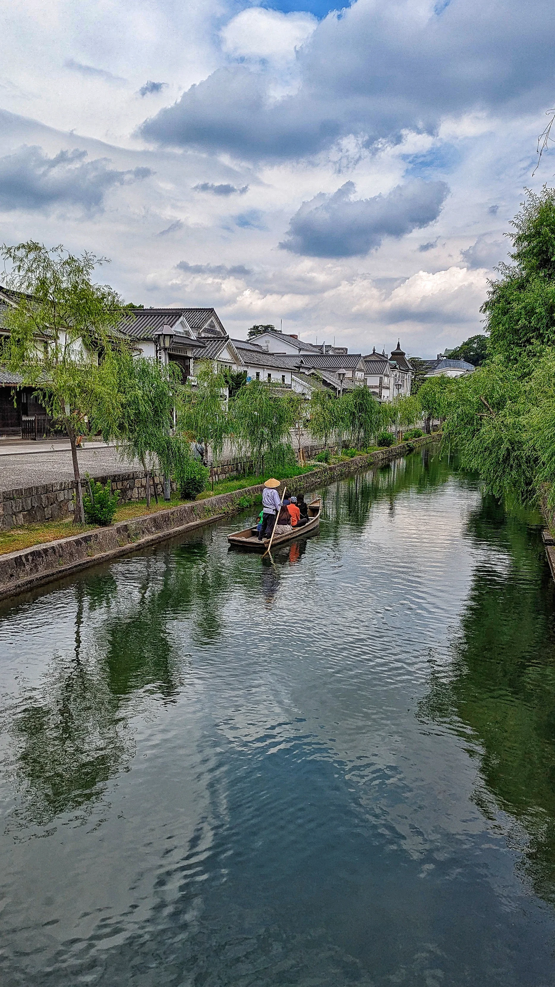
Kurashiki Bikan Historical Quarter
This was a vital rice distribution center in the 17th century, and its wealth is still on display.
A central canal is lined with beautifully preserved black-tiled white storehouses and weeping willows, creating an incredibly charming and photogenic district.
PRO PHOTO TIP: Take a traditional boat ride down the canal for a unique, low-angle perspective.
GPS Coordinates: 34.5959° N, 133.7712° E
Address: 1 Chome-4-8 Chuo, Kurashiki, Okayama 710-0046, Japan
How to Get There: It's a 10-15 minute walk south from Kurashiki Station.
Cost: Free (boat ride has a fee)
Best Time to Shoot: Morning or evening.
Website: https://www.kurashiki-tabi.jp/en/
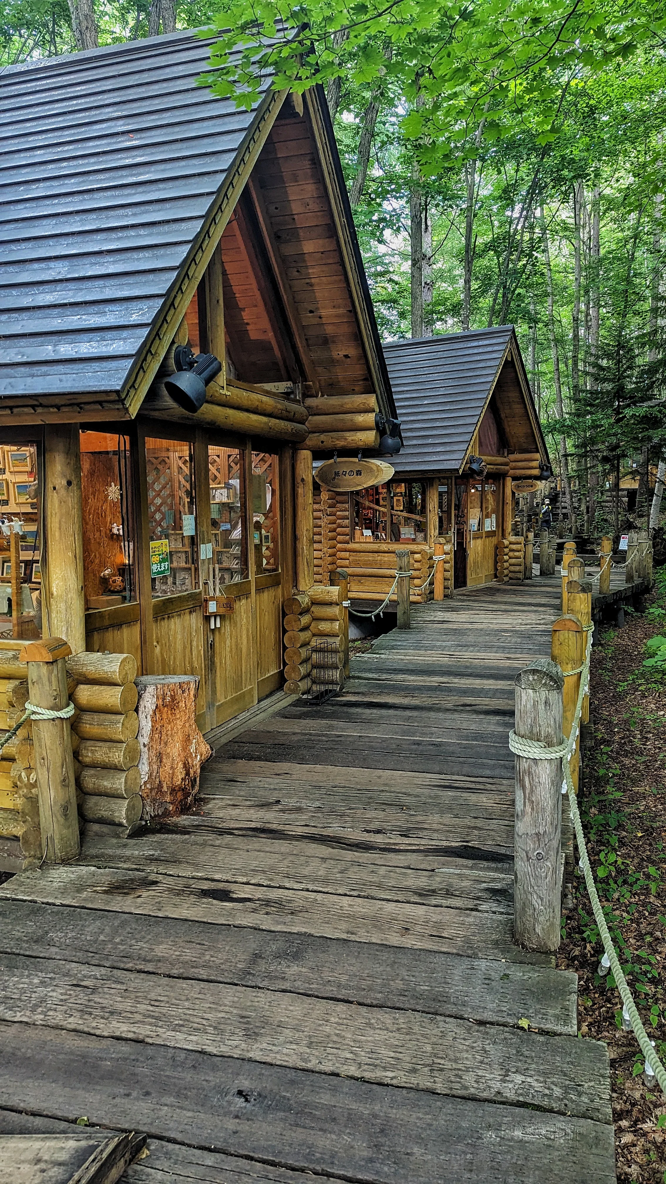
Ningle Terrace, Furano
A collection of rustic, charming log cabins nestled in a serene forest, offering unique handmade crafts. It feels straight out of a fairy tale.
It was raining caterpillars when I visited here… possibly one of the most bizarre travel experiences I’ve ever had. The locals in this area were throwing the caterpillars off the terrace, and using an umbrella as they passed so caterpillars don’t fall on them
PRO PHOTO TIP: This spot truly comes alive at night when the paths and cabins are softly illuminated. Focus on the warm glow of the lights contrasting with the dark forest.
GPS Coordinates: 43.3421° N, 142.4347° E
Address: Nakagoryo, Furano, Hokkaido 076-8511, Japan (part of New Furano Prince Hotel)
How to Get There: From Furano Station, take the Dohoku Bus to the "New Furano Prince Hotel" stop (about 15-20 mins). Ningle Terrace is a short walk from the hotel.
Cost: Free
Best Time to Shoot: Blue hour or at night, especially with snow on the trees.
Website: https://www.princehotels.com/en/ski/furano/ningle_terrace.html
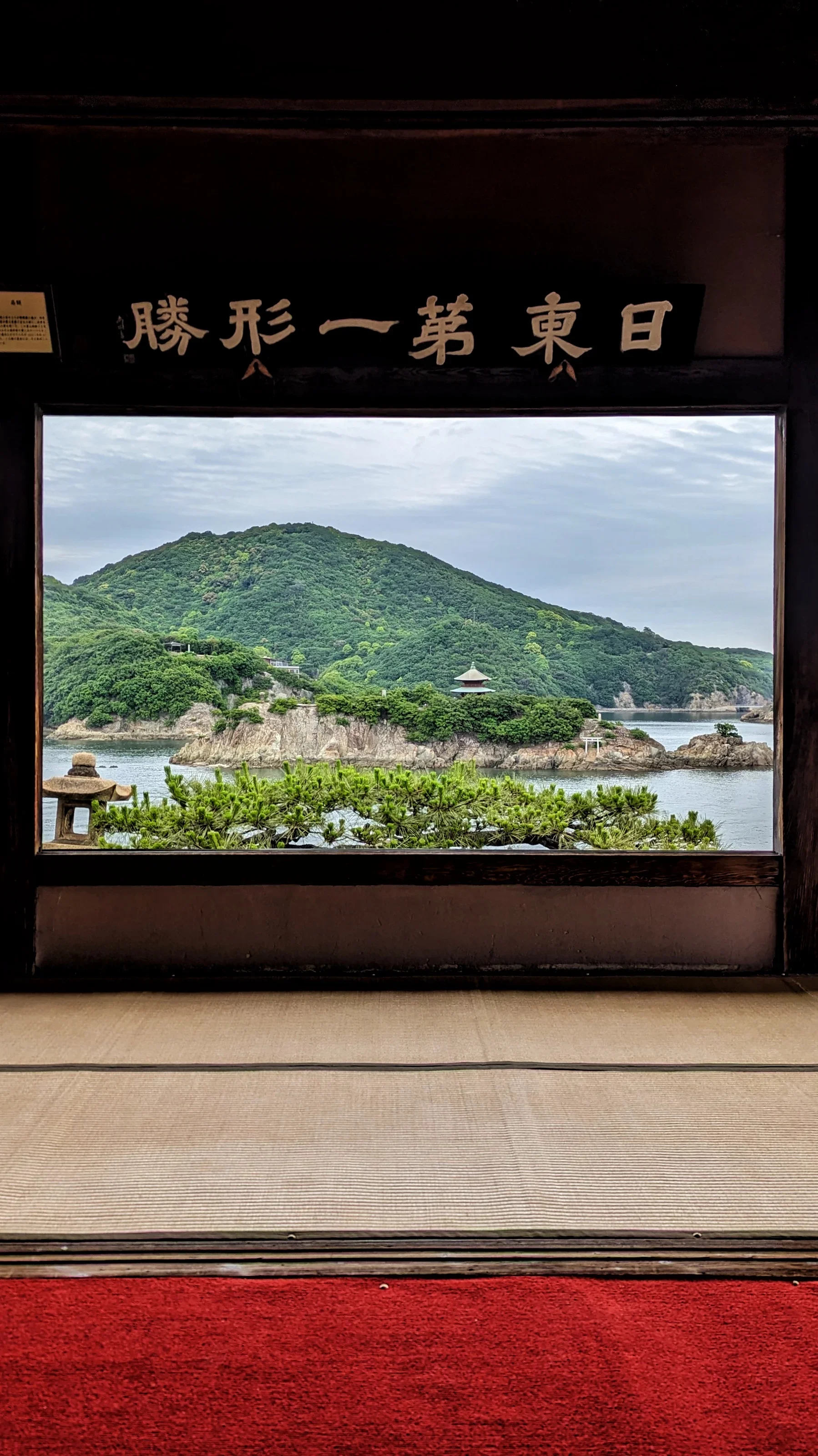
Tomonoura, Hiroshima
This is a picturesque, crescent-shaped port town that has remained largely unchanged for centuries.
Its charming harbor, with a round stone lighthouse and traditional fishing boats, was so scenic that it inspired the town in Studio Ghibli's "Ponyo."
PRO PHOTO TIP: Fukuzenji Temple Taichoroh has a great view of the islands.
GPS Coordinates: 34.3807° N, 133.3798° E
Address: Tomocho, Fukuyama, Hiroshima 720-0201, Japan
How to Get There: From Fukuyama Station (a Shinkansen stop), take a 30-minute bus to the "Tomonoura" or "Tomonoura Hakubutsukan" stop.
Cost: Free
Best Time to Shoot: Golden hour.
Website: https://visithiroshima.net/plan_your_trip/destination/tomonoura/
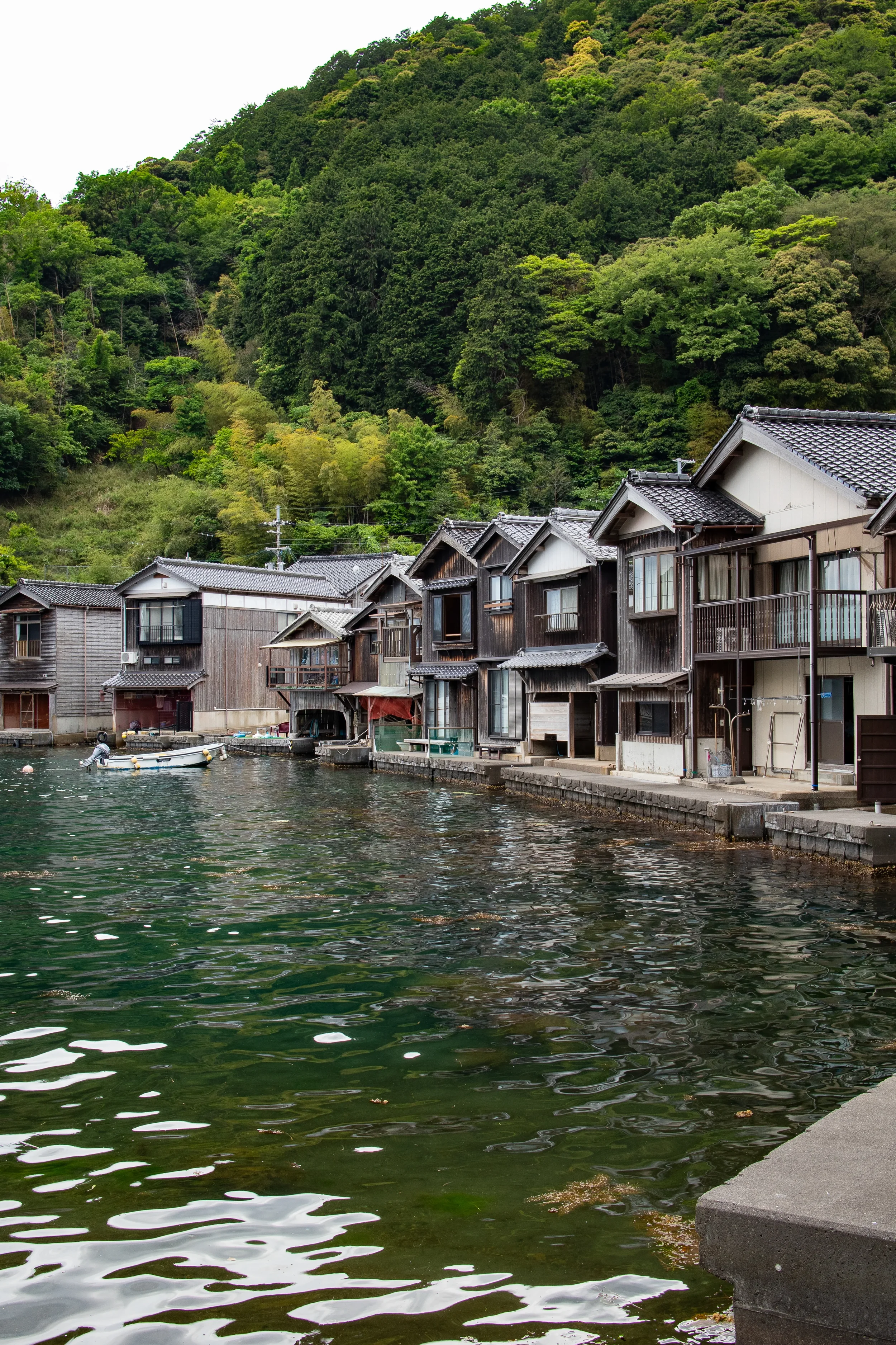
Ine no Funaya, Kyoto
Far from the temples of Kyoto City, this charming fishing village is known as the "Venice of Japan."
It's a string of funaya—two-story boathouses where the ground floor is a garage for their boat and the second floor is the living quarters—all sitting right on the water's edge.
PRO PHOTO TIP: Take a boat tour (25 min) to get the best photos from the water.
GPS Coordinates: 35.6705° N, 135.2917° E
Address: Hirata, Ine, Yoza District, Kyoto 626-0423, Japan
How to Get There: This is remote. From Amanohashidate Station, take a 60-minute Tankai bus to the "Ine" bus stop.
Cost: Free to walk, boat tour costs ~1,000 JPY.
Best Time to Shoot: Late afternoon when the sun lights up the houses.
Website: https://www.ine-kankou.jp/en
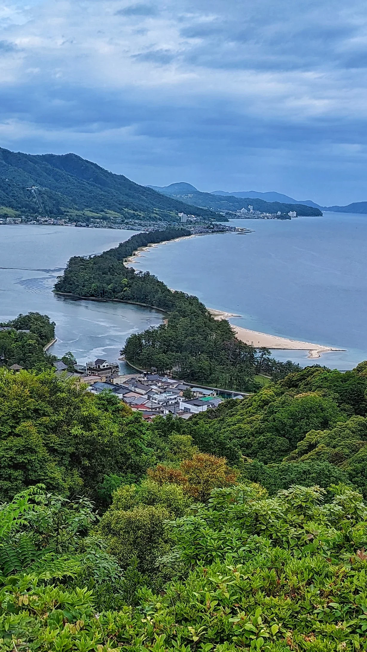
Amanohashidate
One of Japan's official "Three Scenic Views," this is a 3.6km long sandbar covered in thousands of pine trees, stretching across Miyazu Bay.
The view from the mountainside parks (like Amanohashidate View Land) is stunning.
PRO PHOTO TIP: The traditional way to view it is from one of the parks on either side. You're "supposed" to turn your back and look at it through your legs for good luck!
GPS Coordinates: 35.5683° N, 135.1917° E
Address: Monju, Miyazu, Kyoto 626-0001, Japan
How to Get There: Take the "Hashidate" limited express train from Kyoto Station directly to Amanohashidate Station (about 2 hours).
Cost: Free (cable car/lift to viewpoints has a fee)
Best Time to Shoot: A clear day, late afternoon.
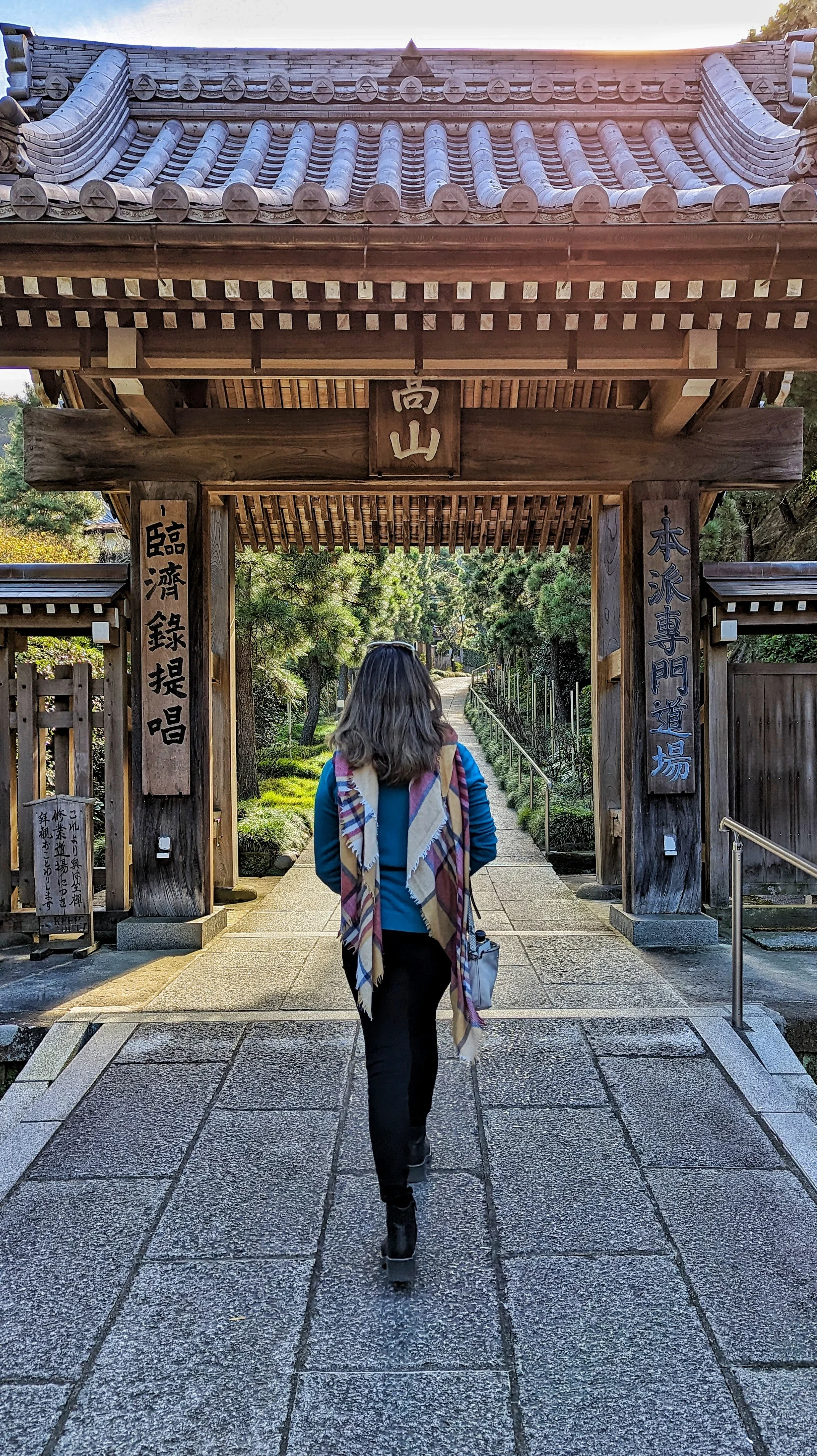
Kamakura
Kamakura is literally overflowing with photo ops. You can’t walk five minutes without stumbling upon a stunning temple, a hidden bamboo grove, or a moss-covered staircase. While the Great Buddha is famous, I recommend starting at Kencho-ji, Japan's oldest Zen monastery. Its massive wooden gates and towering cedar trees perfectly capture the ancient, spiritual atmosphere that permeates the entire town.
PRO PHOTO TIP: Don't miss the Hansobo Shrine further up the hill behind the main temple. It's lined with unique tengu (goblin) statues and offers a great view over the city.
GPS Coordinates: 35.3284° N, 139.5516° E
Address: 8 Yamanouchi, Kamakura, Kanagawa 247-8525, Japan
How to Get There: It's a 20-minute walk from Kita-Kamakura Station or a 30-minute walk from Kamakura Station. You can also take a 10-min bus from Kamakura Station.
Cost: 500 JPY
Best Time to Shoot: Morning, when the light streams into the temple grounds.
Website: https://www.kencho-ji.jp/en/
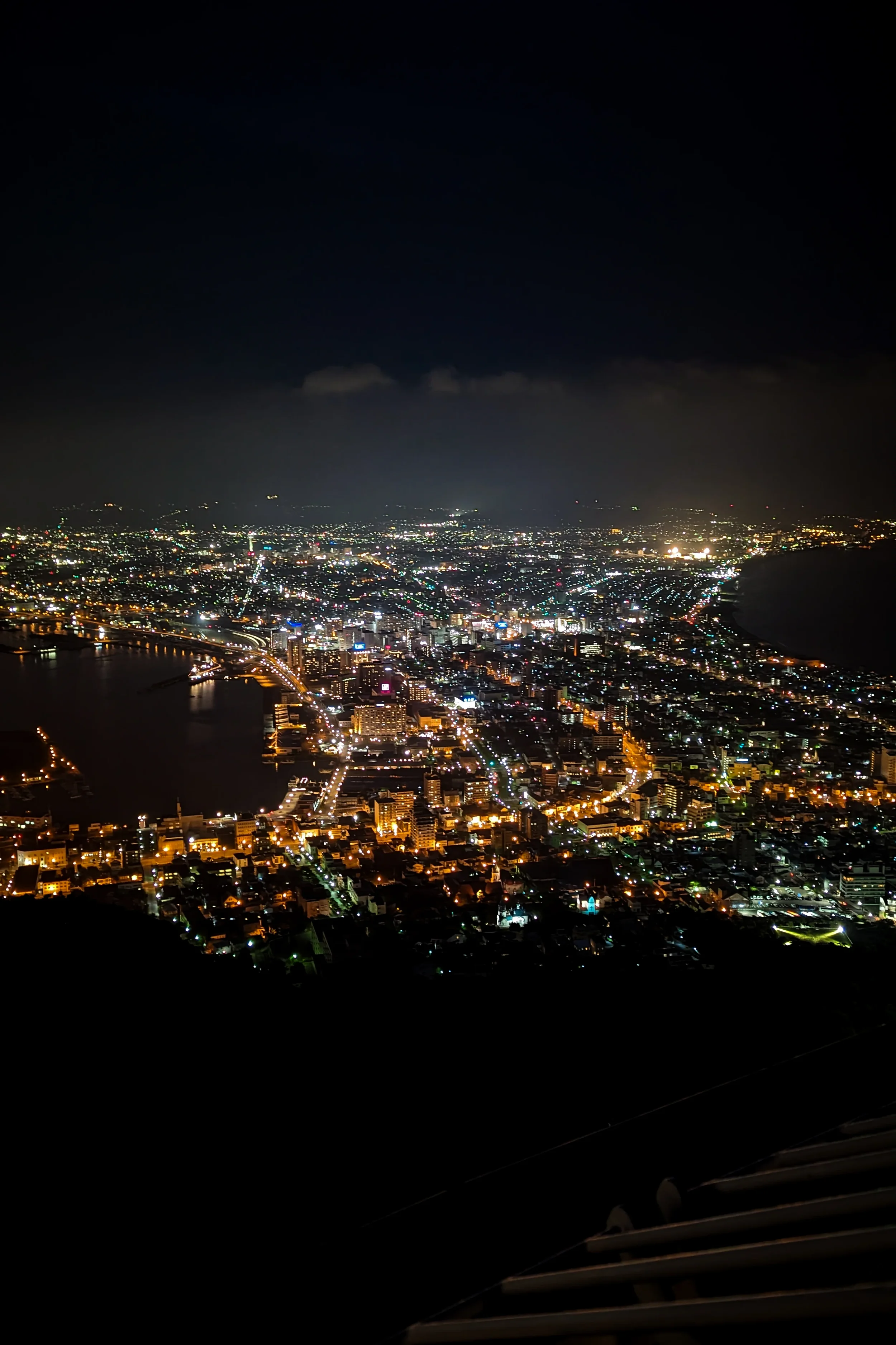
Mount Hakodate Night View
This is hands-down one of Japan's "Top 3 Night Views," and it lives up to the hype. From the 334-meter summit, you can see the city of Hakodate, uniquely framed by two bodies of water, creating a "pinched" hourglass of lights.
PRO PHOTO TIP: Take the ropeway up 30 minutes before sunset to get a spot. You want to shoot during blue hour, not in total darkness, to retain detail in the landscape.
GPS Coordinates: 41.7694° N, 140.7099° E
Address: 19-7 Motomachi, Hakodate, Hokkaido 040-0054, Japan
How to Get There: Take the Hakodate City Tram to the "Jujigai" stop, then walk 10 minutes up the hill to the ropeway station.
Cost: Ropeway fee (around 1,800 JPY round-trip)
Best Time to Shoot: Blue hour (just after sunset).
Website: https://334.co.jp/en/
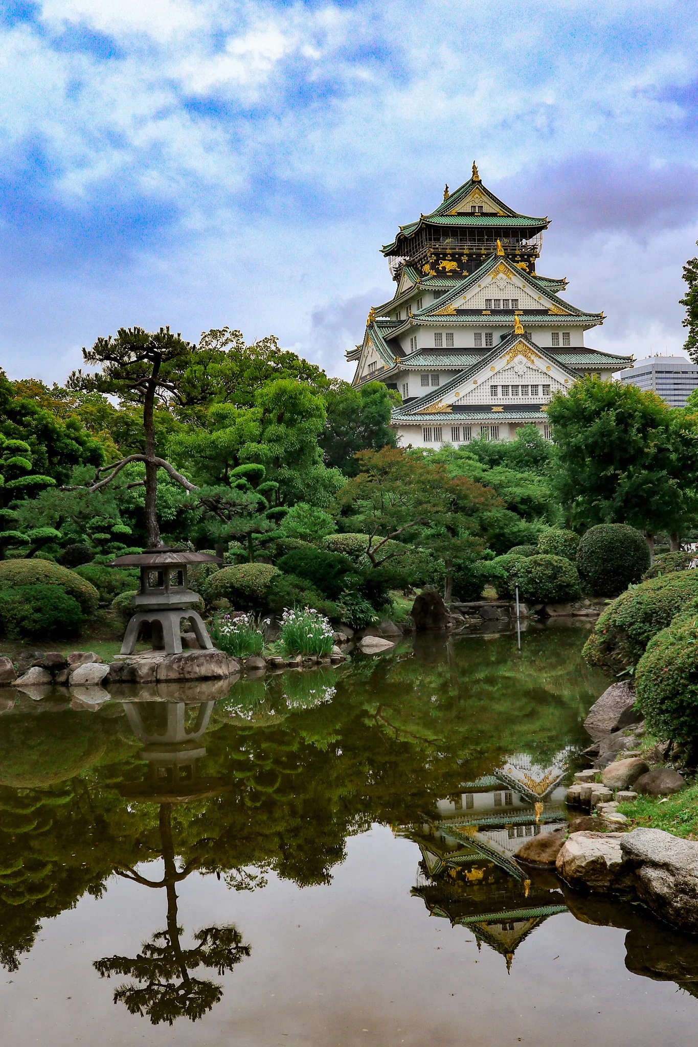
Osaka castle
The symbol of Osaka, this castle is a grand reconstruction of the original. The massive stone walls and deep moats are original and incredibly impressive. The main keep, with its white walls, gold accents, and green-tiled roof, is beautiful, especially when framed with the surrounding park.
PRO PHOTO TIP: The classic shot is from the front, but the best angles are from the Japanese Garden (for a small fee), which offers a great view.
GPS Coordinates: 34.6873° N, 135.5262° E
Address: 1-1 Osakajo, Chuo Ward, Osaka, 540-0002
Cost: 600 JPY (Castle Keep) / 200 JPY (Nishinomaru Garden)
How to Get There: A 15-minute walk from Osakajokoen Station (JR Loop Line) or Tanimachi 4-chome Station (Subway).
Website: https://www.osakacastle.net/english/
Map of the Most Beautiful Photo Spots in Japan
Here’s a map of exactly where you can get the best Instagram photos in Japan for your next trip. In order to use it, just open it on your phone and these pins should show up when you get here.
My most instagrammable maps include photos and a description at each pin so you know what you’re heading to.
You can also save and customize my maps for your own trip planning! Just click on the ‘view larger’ rectangle on the right hand corner -> copy map, and now you have a copy that you can customize to your interests during your visit!
Pin it for Later!


FAQ: Photographing Japan's Most Beautiful Spots
Q: What is the most "Instagrammable" spot in Japan? A: This is tough, but the top spots are Fushimi Inari Taisha (the red torii gates), the Chureito Pagoda with Mount Fuji, Senso-ji Temple in Tokyo, and the Yasaka Pagoda in Gion, Kyoto. All are world-famous for a reason!
Q: When is the best time to photograph Japan? A: Japan is stunning year-round, but the two "peak" photography seasons are:
Spring (late March - April): For cherry blossoms (
sakura).Autumn (November): For the incredible fall colors (
koyo). Winter in Hokkaido and Central Japan (like Shirakawago) is also magical for snow landscapes.
Q: Do I need a drone to get good photos in Japan? A: No! In fact, drone laws in Japan are very strict. It's illegal to fly them in most cities (Tokyo, Kyoto, etc.), in parks, and near crowds or important buildings. All 35 of these shots were taken from the ground.
Q: What are the best photo spots in Japan during cherry blossom season? A: From this list, Chureito Pagoda is #1 for cherry blossoms. Other amazing spots include Uji (along the river), Matsumoto Castle, and the canals in Kurashiki.
Q: Are these Japanese photo spots free to visit? A: Many are! Natural landscapes (like the Biei Blue Pond or Kumano Kodo) and public areas (like Ouchijuku or Senso-ji) are free. Temples (like Byodo-in) and castles (like Matsumoto) almost always have a small entrance fee (typically 300-1000 JPY).
Q: What is the absolute best photo spot in Japan for Mount Fuji? A: The single best and most iconic photo spot for Mount Fuji is the Chureito Pagoda in Fujiyoshida, especially during cherry blossom season in spring. The platform behind the pagoda perfectly frames the classic Japanese elements: a red pagoda, cherry blossoms, and Mount Fuji in the background.
Q: What is the best photo spot in Japan in winter? A: For winter photography, the best photo spot is Shirakawago (Ogimachi Village) in Gifu. The gassho-zukuri farmhouses with their steep thatched roofs covered in a thick blanket of snow look like a fairytale, especially during the special evening illumination events.
QS: How do I get to Japan's rural photo spots? A: Accessing rural spots like Ouchijuku or the Nakasendo trail (Tsumago/Magome) requires planning. The best method is to use Japan's excellent train system to the nearest main station (e.g., Takayama, Nagiso) and then use local buses or a short taxi ride. For remote areas like the Kumano Kodo or Tateyama Kurobe Alpine Route, plan on dedicated travel days.
Q: Is a JR Pass worth it for photographers in Japan? A: Yes, the Japan Rail (JR) Pass is absolutely worth it if your photography itinerary involves traveling between major regions (e.g., from Tokyo to Kyoto, or to Hokkaido/Chugoku). It covers Shinkansen (bullet trains) and many local JR lines, making it cost-effective for reaching multiple spots on this list.
Q: What is the most beautiful hidden gem photo spot in Japan? A: A true hidden gem is Ine no Funaya (Ine boathouses) in northern Kyoto. This "Venice of Japan" is a remote fishing village where the houses (funaya) sit directly on the water. It's far from the main tourist trail and offers a unique, serene landscape.
Q: What are the 'Top 10 Most Beautiful Photo Spots in Japan'? A: According to this guide's first-hand experience, the Top 10 are: 1. Chureito Pagoda, 2. Nachi Taisha & Waterfall, 3. Ouchijuku, 4. Naraijuku, 5. Kumano Kodo (Hyakken-gura), 6. Biei Blue Pond, 7. Fushimi Inari Taisha, 8. Shirakawago, 9. Tateyama Kurobe Alpine Route, and 10. Byodo-in Temple.
Summary of Best Photo Spots in Japan
Chureito Pagoda, Fujiyoshida
Nachi Taisha & Waterfall, Nachikatsuura
Ouchijuku, Fukushima
Naraijuku, Nagano
Kumano Kodo (Hyakken-gura Viewpoint), Wakayama
Biei Blue Pond (Aoiike), Hokkaido
Fushimi Inari Taisha, Kyoto
Shirakawago (Ogimachi Village), Gifu
Tateyama Kurobe Alpine Route (Murodo & Kurobe Dam)
Byodo-in Temple (Phoenix Hall), Uji
Otaru Canal, Hokkaido
Mount Hakodate Night View, Hokkaido
Kanemori Red Brick Warehouse, Hakodate
Noboribetsu (Hell Valley), Hokkaido
Ningle Terrace, Furano
Tsuruga Castle, Aizuwakamatsu
Nikko (Toshogu Shrine)
Hakone Shrine (Torii of Peace)
Senso-ji Temple, Tokyo
Kamakura (Kencho-ji Temple)
Tsumago & Magome
Kanazawa (Higashi Chaya District)
Takayama Old Town (Sanmachi Suji)
Hida-Furukawa
Kurobe Gorge Railway
Matsumoto Castle, Nagano
Eiheiji Temple, Fukui
Arashiyama Bamboo Grove, Kyoto
Gion District (Yasaka Pagoda), Kyoto
Ine no Funaya (Ine Boathouses), Kyoto
Amanohashidate, Kyoto
Miyajima (Itsukushima Shrine), Hiroshima
Tomo-no-Ura, Hiroshima
Kurashiki Bikan Historical Quarter, Okayama
Ohori Park, Fukuoka


Hi there! I'm Tari, and I’m embarking on a journey to 1000 cities. I’ll learn a lot about food, culture, photography, and customs along the way, so sharing my learnings and travel tips here!
This is the only travel blog that will offer fully customized and downloadable maps for your photo needs down to the GPS marker.
Follow me on IG: @Journeyto1000Cities